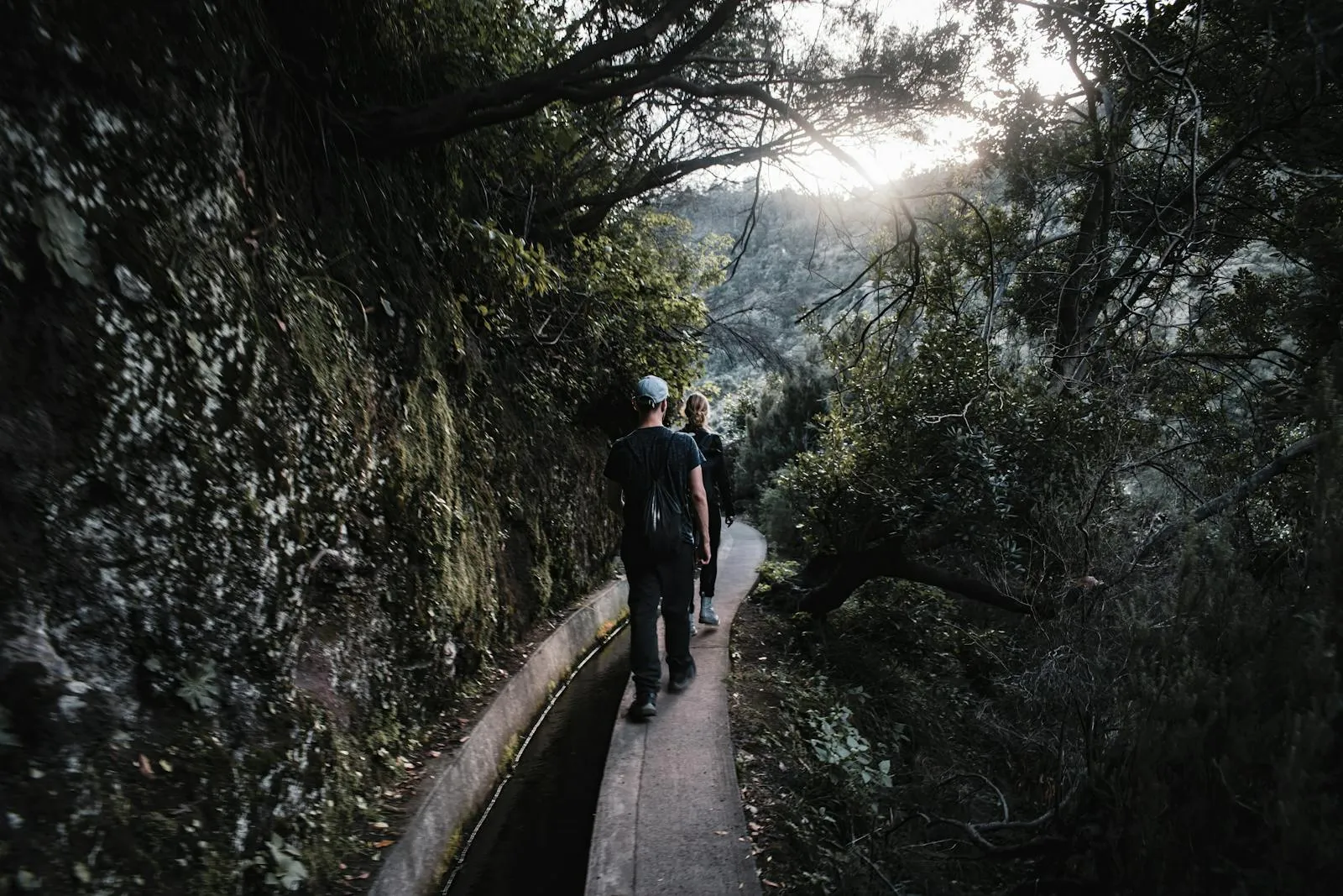
Hiking is the main reason most people come to Madeira. The island has over 30 official "PR" (Pequena Rota) trails maintained by the regional government, plus dozens of unofficial paths. There are two types of trail. Levadas follow the historic irrigation channels that carry water from the wet north to the dry south. They are mostly flat, follow gentle gradients through forest, and are accessible to anyone in reasonable fitness. Veredas are mountain paths, steeper and more exposed, sometimes with serious drop-offs and vertigo-inducing ridgelines.
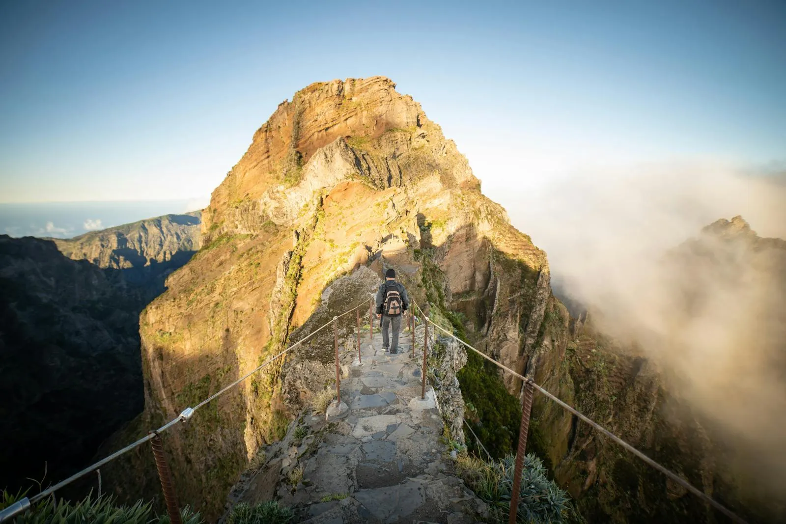
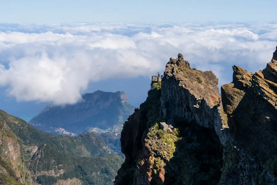
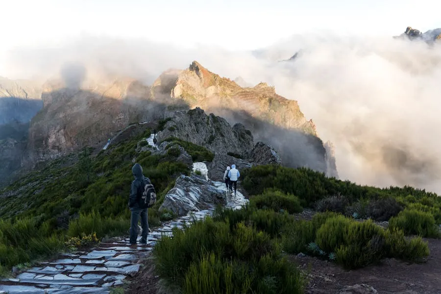
PR1: Pico do Arieiro → Pico Ruivo
Distance: 15.6 km | Duration: 7–8 h | Elevation: +1,000 m | Difficulty: Hard
Fee: €10.50 | Exposure: 5/5 (extreme)
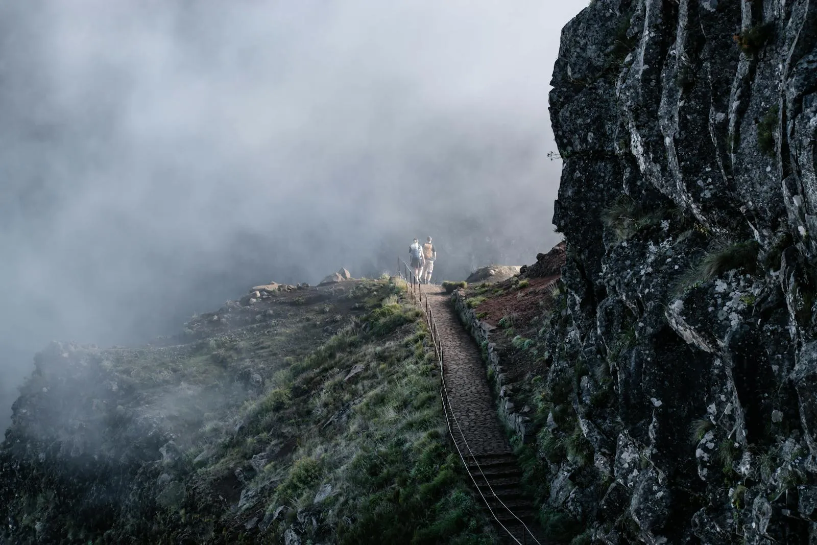
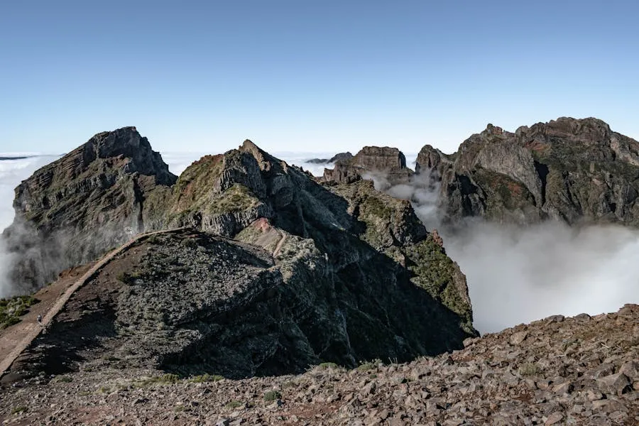
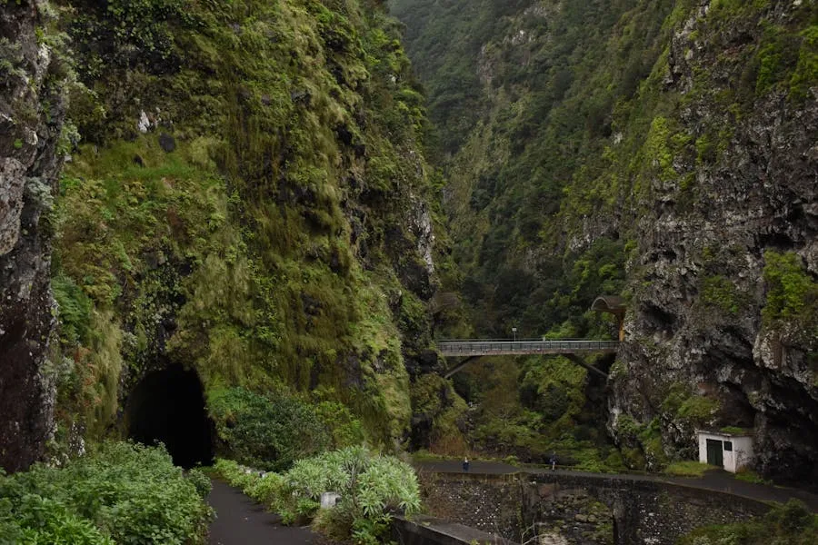
The trail that put Madeira on the hiking map. A ridge traverse between the island's two highest peaks (1,818 m and 1,862 m), passing through tunnels carved into volcanic rock and along knife-edge ridges with 500 m drops on both sides. On clear mornings you walk above a sea of clouds with the Canary Islands visible on the horizon.
The August 2024 wildfire destroyed sections of the trail infrastructure and severely damaged the laurel forest. After 20 months of reconstruction, PR1 reopened on 27 April 2026 with significant changes. The trail is now one-way only (Arieiro to Ruivo). The east path via Pico das Torres remains closed. During the initial phase, access is limited to Friday through Sunday while maintenance continues on weekdays. Damaged wooden sections have been replaced with fire-resistant materials, and new safety cables line the most exposed ridgeline sections.
The landscape is rawer now. Stripped laurel stumps, exposed volcanic rock, regenerating scrub where ancient trees once stood. Still spectacular, but a different kind of spectacular. Since the trail is one-way, you need to arrange transport from Achada do Teixeira back to your car at Arieiro (taxi ~€25, or park at Achada and start from the Ruivo end if heading the opposite direction is permitted later).
PR1 logistics: Book the earliest morning slot (7:00–8:30). Bring a headtorch (tunnels), windproof layers, and at least 2L of water. Check the mountain forecast for Pico do Arieiro specifically, not Funchal. If fog or strong wind is predicted above 1,500 m, skip it. Consider PR1.2 from Achada do Teixeira (5.6 km return, much less exposed) as an alternative that still reaches the Pico Ruivo summit.
PR6: Levada das 25 Fontes
Distance: 11 km return | Duration: 3–4 h | Elevation: +324 m | Difficulty: Moderate
Fee: €4.50 | Exposure: 3/5 (moderate)
Madeira's most popular levada walk and for good reason. The trail follows an irrigation channel from Rabaçal through dense laurisilva forest to a waterfall pool fed by 25 natural springs. The forest canopy, the sound of running water, and the green light filtering through moss-draped trees make this feel like walking through a prehistoric landscape.
There is one 800 m tunnel along the route. A proper headlamp is essential, not just a phone torch. The tunnel floor can be flooded and uneven. The trail now operates a one-way circulation system: outbound to 25 Fontes via the levada, return via an alternative bypass route. This reduces congestion on the narrowest sections.
Can be combined with the Risco waterfall detour (PR6.1, adds about 1 h). Risco is a 100 m cascade that you view from below. Both trails start from the Rabaçal area on the Paul da Serra plateau. Drive to Rabaçal or take the shuttle from the road above. In July and August, morning slots fill days in advance. May, September, and October offer the same experience with half the crowds.
PR9: Caldeirão Verde (Green Cauldron)
Distance: 17.4 km return | Duration: 5–7 h | Elevation: +148 m | Difficulty: Easy-Moderate
Fee: €4.50 | Exposure: 3/5 (moderate)
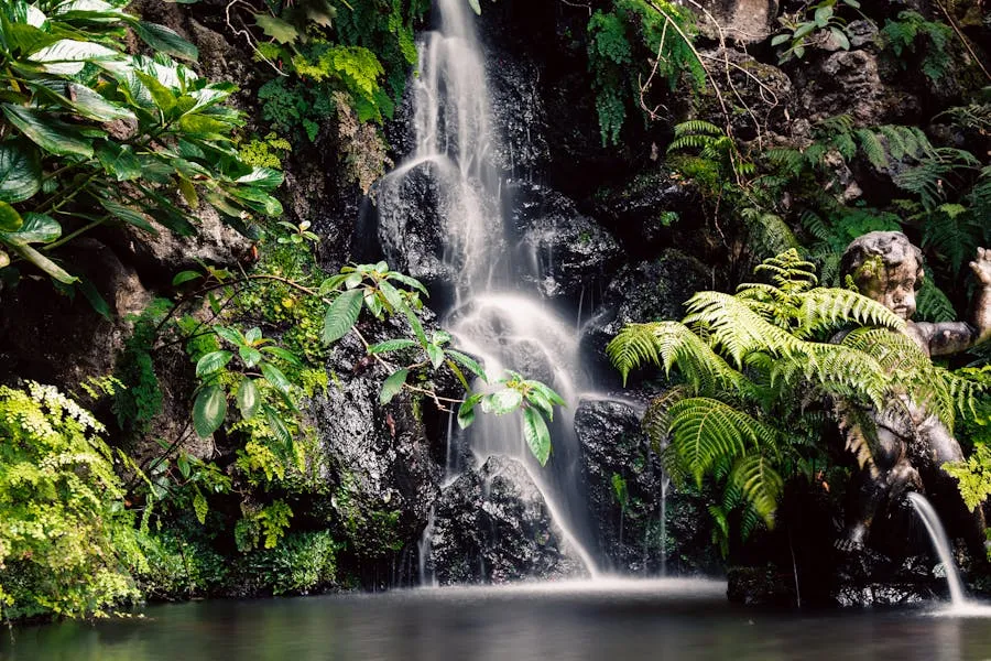
A deep-forest traverse starting from the UNESCO heritage site of Queimadas above Santana. The trail follows a narrow levada path clinging to basalt cliffs through some of the densest laurisilva on the island. It culminates in the "Green Cauldron," a 100 m waterfall dropping into a cold emerald lagoon ringed by vertical moss-covered walls.
The path is remarkably flat but technically demanding because of its physical constraints. Much of the 17 km is spent walking on the narrow stone edge of the levada, less than a metre wide in places, with the rock wall on one side arching over the path and a significant drop on the other. Wire cables are present in the most exposed areas, but they are for balance, not leaning.
There are four tunnels on this route, carved through solid volcanic rock. Some have low ceilings that require a sustained crouch. Floors are often flooded or covered in deep mud. A proper headlamp (not a phone) is genuinely important. The cauldron itself traps cold air and constant spray, easily 5–7°C cooler than the trailhead even on a warm day.
Trail status: PR9 is subject to periodic closures due to weather, rockfall, or maintenance. Always check the
IFCN trail status page before booking. Can be extended to Caldeirão do Inferno (adds 2–3 h, rougher terrain).
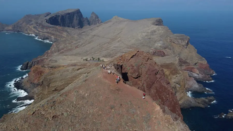
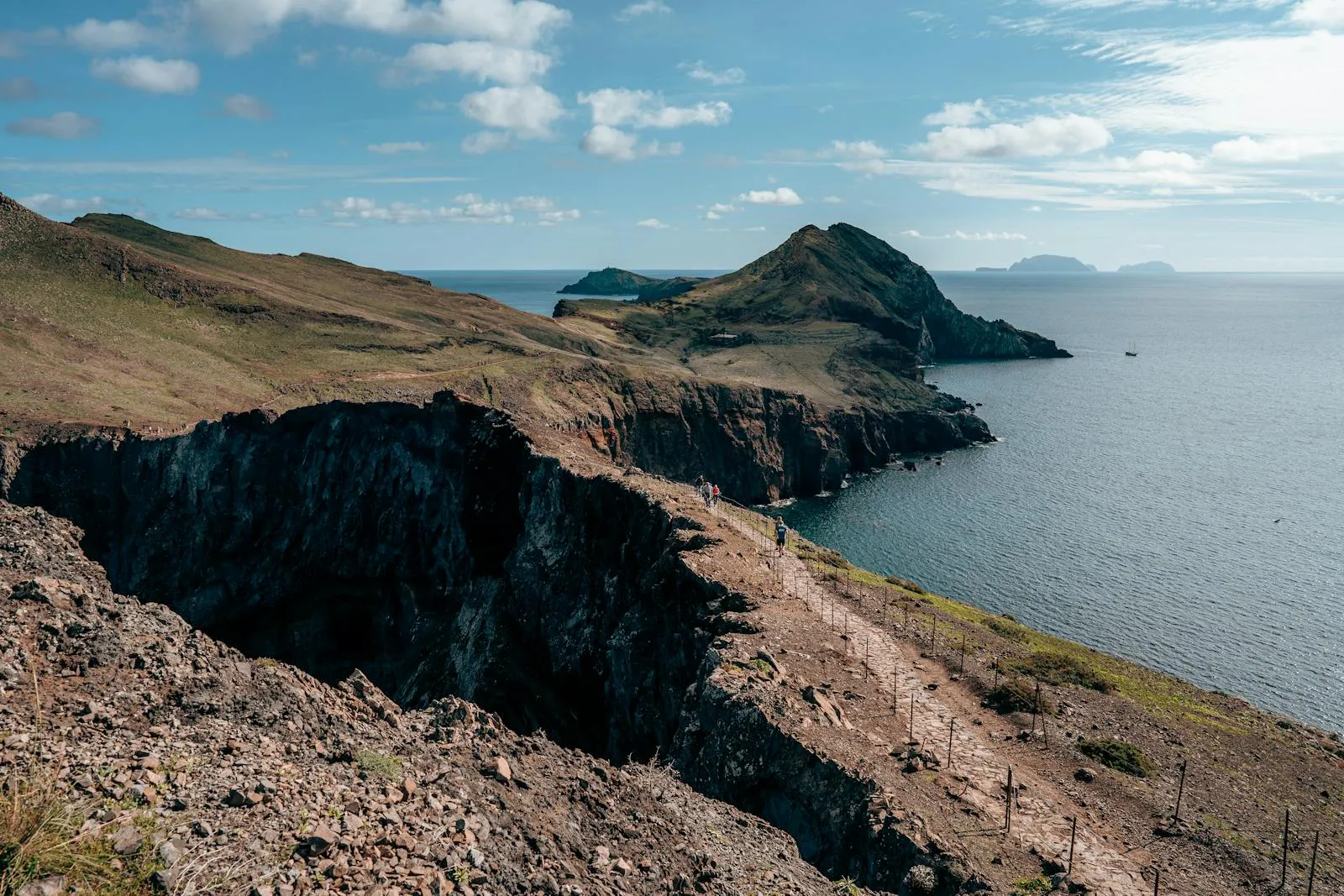
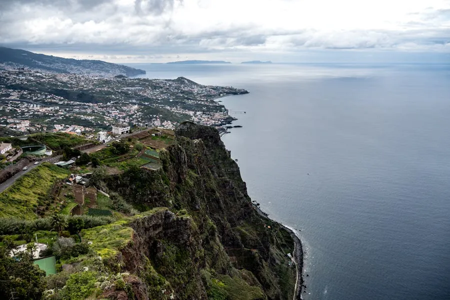
PR8: Ponta de São Lourenço
Distance: 7 km return | Duration: 2.5–4 h | Elevation: +150 m | Difficulty: Easy-Moderate
Fee: €4.50 | Exposure: 2/5 (low)
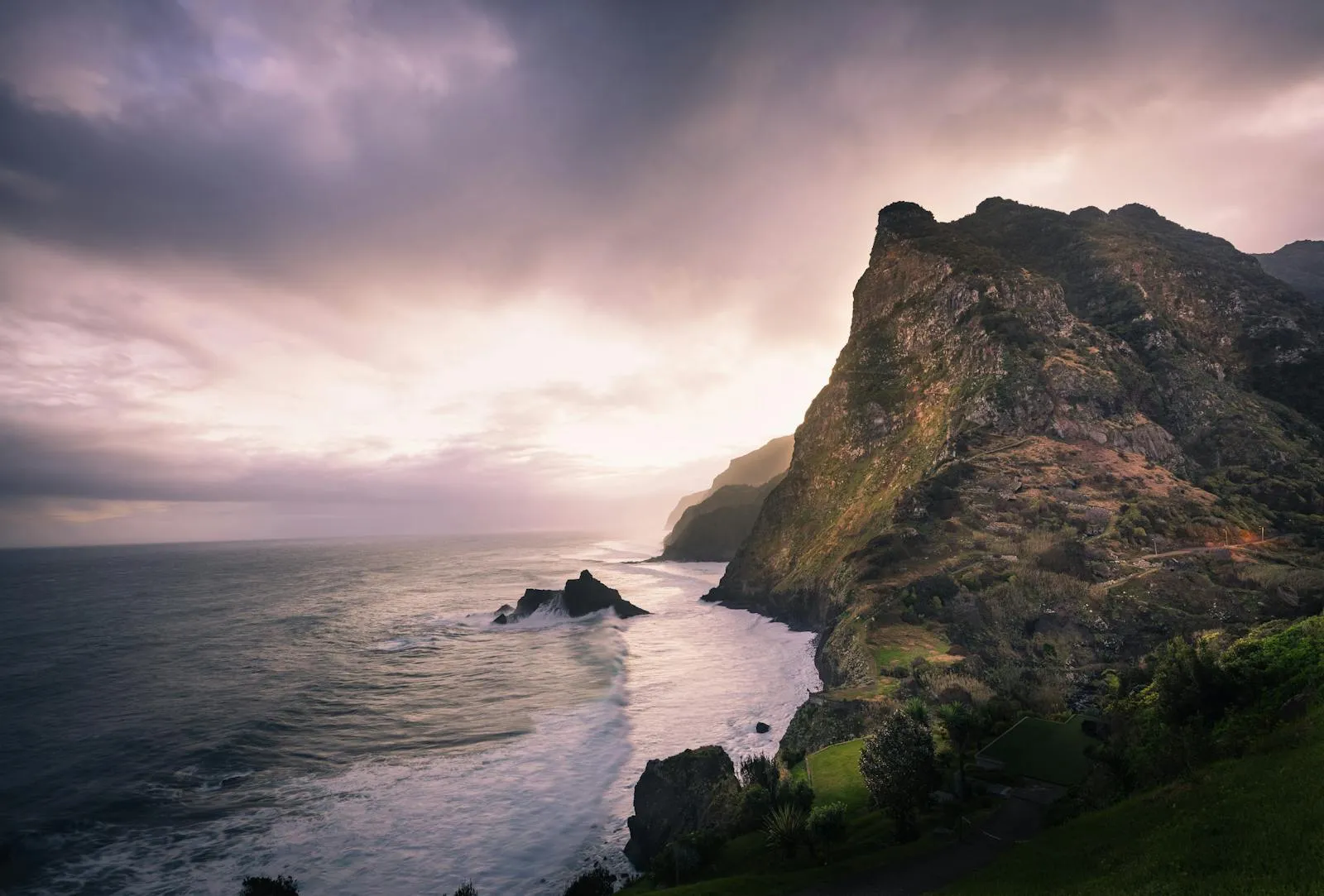
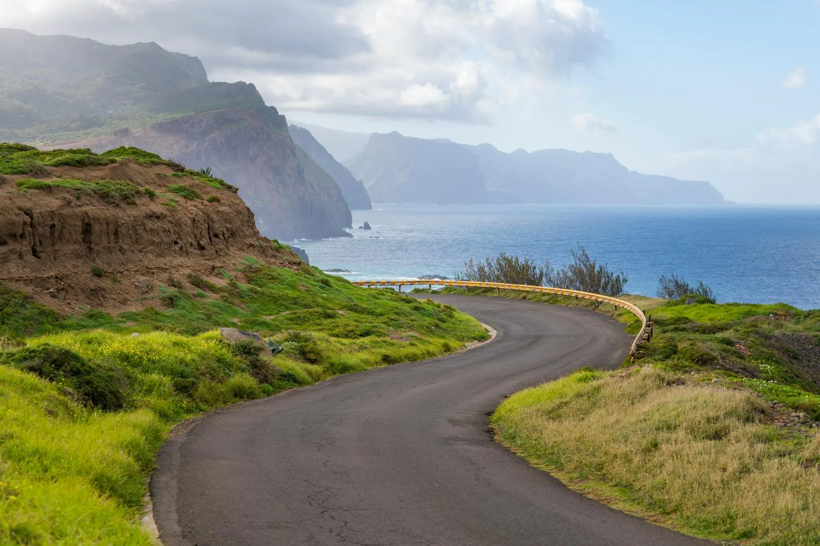
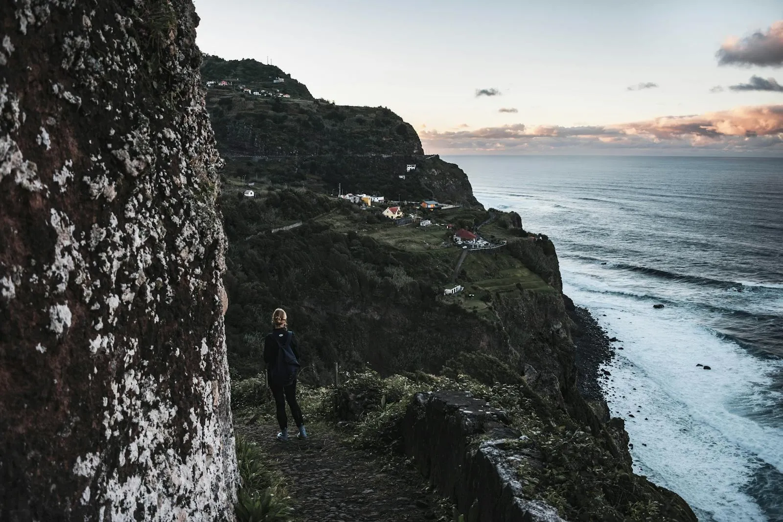
Completely different from every other trail on the island. Instead of green forest, you walk along a barren peninsula of red and ochre volcanic rock jutting into the Atlantic. Ocean on both sides, crashing waves below, and on clear days you can see Porto Santo island 50 km to the northeast. The landscape looks more like the Canary Islands than the rest of Madeira.
No shade, no shelter, no trees. Wind can be fierce, especially in the afternoon. Bring plenty of water, sun protection, and a windproof layer. The trail includes some scrambling over rocky sections but nothing technical. The car park at Baía d'Abra fills early in summer, so arrive before 9:00 or go late afternoon. Avoid weekends if you can. This is the most crowded trail on the island on Saturday mornings.
PR18: Levada do Rei (King's Levada)
Distance: 10 km return | Duration: 3–4 h | Elevation: +100 m | Difficulty: Easy-Moderate
Fee: €4.50 | Exposure: 2/5 (low)
If PR6 (25 Fontes) is too crowded for your taste, this is the alternative. A forest-immersion levada walk on the north side of the island near Santana, with waterfalls, deep green valleys, and far fewer people. The trail follows one of Madeira's most important irrigation channels through dense vegetation. Less famous than PR6 or PR9 but just as atmospheric on a misty morning.
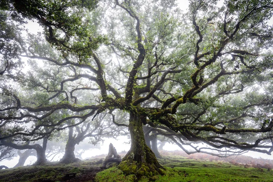
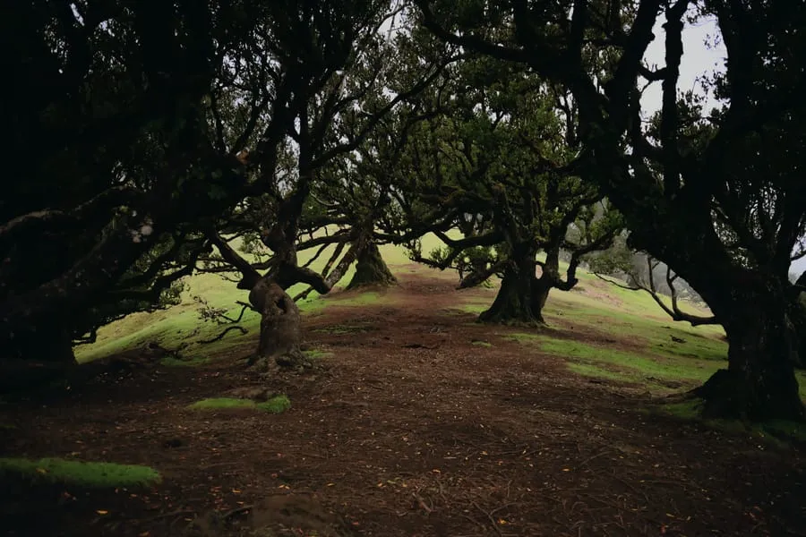
PR13: Vereda do Fanal
Distance: 10.8 km | Duration: 3.5–4.5 h | Elevation: +350 m | Difficulty: Moderate
Fee: Free | Exposure: 2/5 (low)
A circular walk through the UNESCO laurisilva forest around the Fanal area on the Paul da Serra plateau. The ancient laurel grove here, with its twisted, moss-covered trunks standing in open meadows, is one of the most photographed spots on Madeira. When fog rolls through (which it frequently does), the landscape becomes genuinely otherworldly. The full PR13 loop takes you deeper into the forest beyond the easily accessible grove.
PR11: Vereda dos Balcões
Distance: 3 km return | Duration: 45 min–1.5 h | Elevation: +20 m | Difficulty: Easy
Fee: Free | Exposure: 1/5 (none)
The shortest and easiest "real" trail on the island. A flat levada path from Ribeiro Frio to a viewpoint overlooking the central mountain valley with Pico do Arieiro and Pico Ruivo visible above. Wheelchair-accessible for most of the route. Good option for a rest day between harder hikes or when clouds block the peaks. The trout farm at Ribeiro Frio is worth a quick stop on the way.
PR1.2: Vereda do Pico Ruivo (Achada do Teixeira)
Distance: 5.6 km return | Duration: 1.5–2 h | Elevation: +200 m | Difficulty: Easy-Moderate
Fee: €4.50 | Exposure: 2/5 (low)
The sensible alternative to PR1 if you have vertigo issues, limited time, or just want to reach Madeira's highest point without the full ridge traverse. Start from Achada do Teixeira, hike up well-maintained stone steps to the Pico Ruivo shelter and summit (1,862 m). Same 360° views from the top. A fraction of the exposure. On clear days, you can see Porto Santo and sometimes even the Canary Islands. Combine with PR11 (Balcões) in the same day for a satisfying double.
Madeira is not a classic beach destination. The coastline is mostly rocky cliffs, and the few beaches are small pebble or imported-sand affairs. But the ocean here is something special. Deep Atlantic water close to shore means excellent visibility, marine life, and the chance to see whales and dolphins year-round. The south coast is sheltered enough for most water activities; the north can be rough.
Whale & Dolphin Watching
Multiple species of whales and dolphins pass through Madeiran waters year-round. Sperm whales, pilot whales, bottlenose dolphins, and spotted dolphins are the most common sightings. Several operators run half-day trips from Funchal marina (€35–55). Sighting rates are high, around 90% according to most operators. Best months: April through October, but trips run year-round.
Diving & Snorkelling
Clear water (15–30 m visibility), volcanic reef structures, and a marine reserve (Garajau) make Madeira a surprisingly good dive destination. The Garajau reserve has large groupers accustomed to divers. Several wrecks are accessible. Water temperature: 17–23°C depending on season. A two-dive package runs €60–90. Snorkelling is possible from several rocky shore points, particularly around Ponta de São Lourenço and the Garajau area.
Swimming
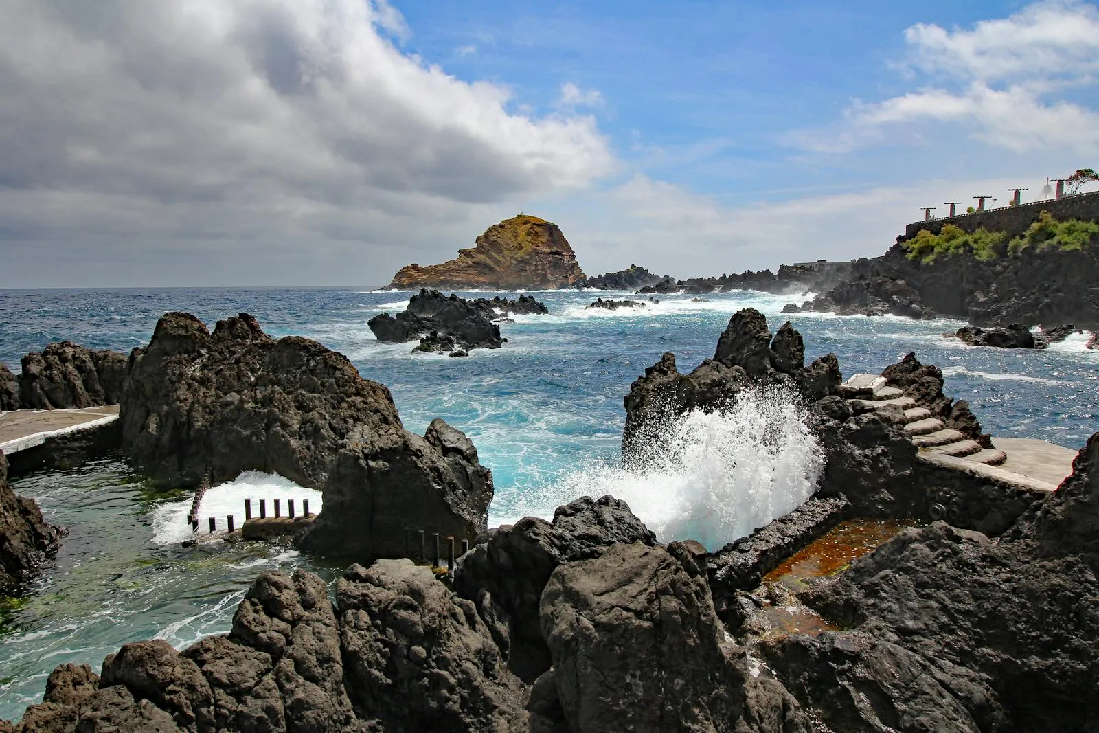
Forget long sandy beaches. Madeira's swimming options are rock pools (Porto Moniz, Seixal, Doca do Cavacas in Funchal), lido complexes (€3–8 entry), and a handful of small beaches (Calheta's imported sand, Machico's beach, Praínha's natural pebble cove). The lido culture is strong. Funchal's Barreirinha and Ponta Gorda lidos are popular with locals and visitors alike.
Coasteering & Stand-Up Paddling
Coasteering trips (cliff jumping, swimming, scrambling along the coast) operate mainly from the south coast. €40–60 per person. SUP rentals are available at Calheta and some hotel beaches. The south coast is calm enough for beginners on most days.
Vereda do Larano (PR5.2)
A coastal trail between Machico and Porto da Cruz that most visitors skip in favour of São Lourenço. Less dramatic but also less crowded, with views of the north coast cliffs and banana terraces. About 3 hours one-way. Combine with a visit to Porto da Cruz's old sugar cane factory.
Fanal (Chão dos Louros)
An ancient laurel grove on the Paul da Serra plateau where twisted, moss-covered trees stand in open meadows. When fog rolls through (which it often does), the landscape looks otherworldly. Free to visit. There is a small car park and a forest warden station. No facilities. Best in early morning when fog is most likely.
Praínha Beach
A tiny natural pebble beach between Caniçal and São Lourenço. Sheltered cove with a small restaurant above. Few tourists know about it because it is not on the main road. A short walk down from the car park. One of the best swimming spots on the island with no entrance fee.
Boca da Corrida Viewpoint
A viewpoint above Curral das Freiras that most tour buses skip because the access road is narrow. The view down into the valley is more dramatic than the more famous Eira do Serrado viewpoint nearby. Starting point for a trail down into the valley floor. Free and usually empty.
Poncha Bars in Serra de Água
The mountain village of Serra de Água on the Encumeada road has a few tiny bars where locals drink poncha made from locally grown sugar cane. No tourist scene. Prices are about half of Funchal. The road from Ribeira Brava up through the valley is beautiful on its own.
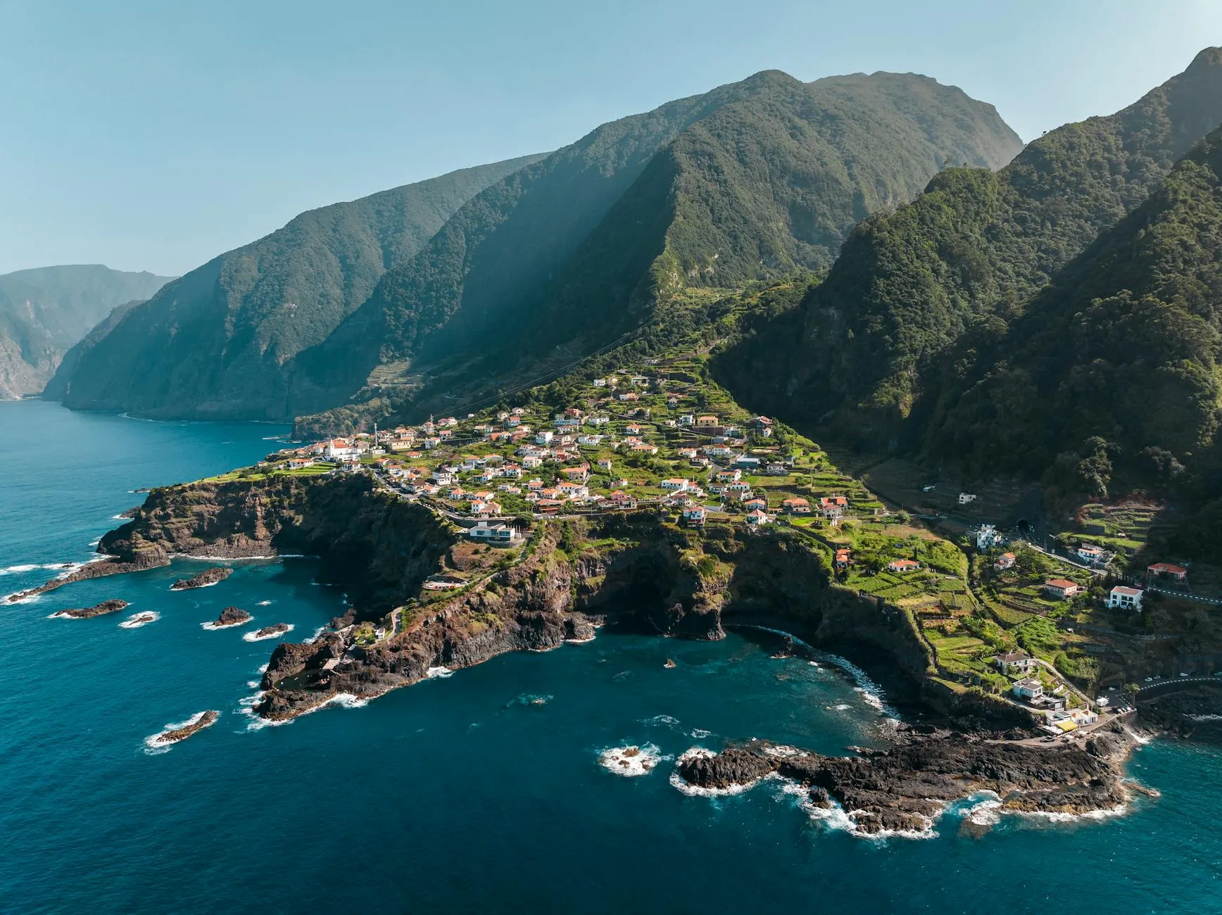
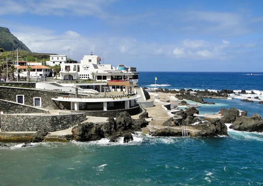
Seixal Beach & Natural Pool
On the north coast between São Vicente and Porto Moniz. A black volcanic sand beach backed by cliffs, with a natural rock pool nearby. Far less visited than Porto Moniz because most day-trippers turn around before reaching it. The beach is wild and exposed. Swimming is only safe on calm days.