Namibia Travel Guide

The oldest desert on Earth, the emptiest roads in Africa, and a sky so vast it redefines silence

🇳🇦 Namibia Self-Drive Adventure Mid-Range Budget

Overview & Why Visit Namibia

Namibian desert landscape with towering red dunes

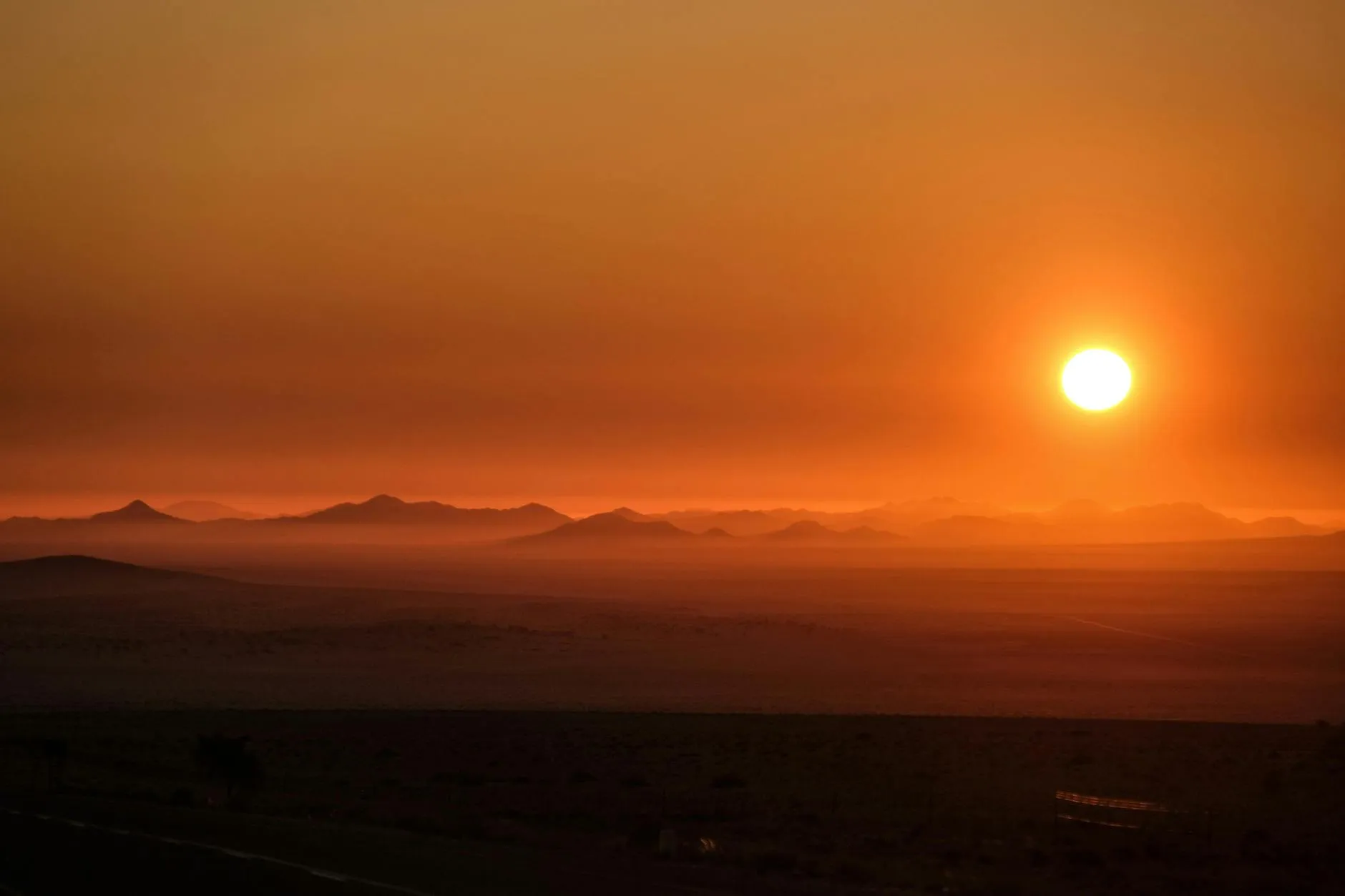
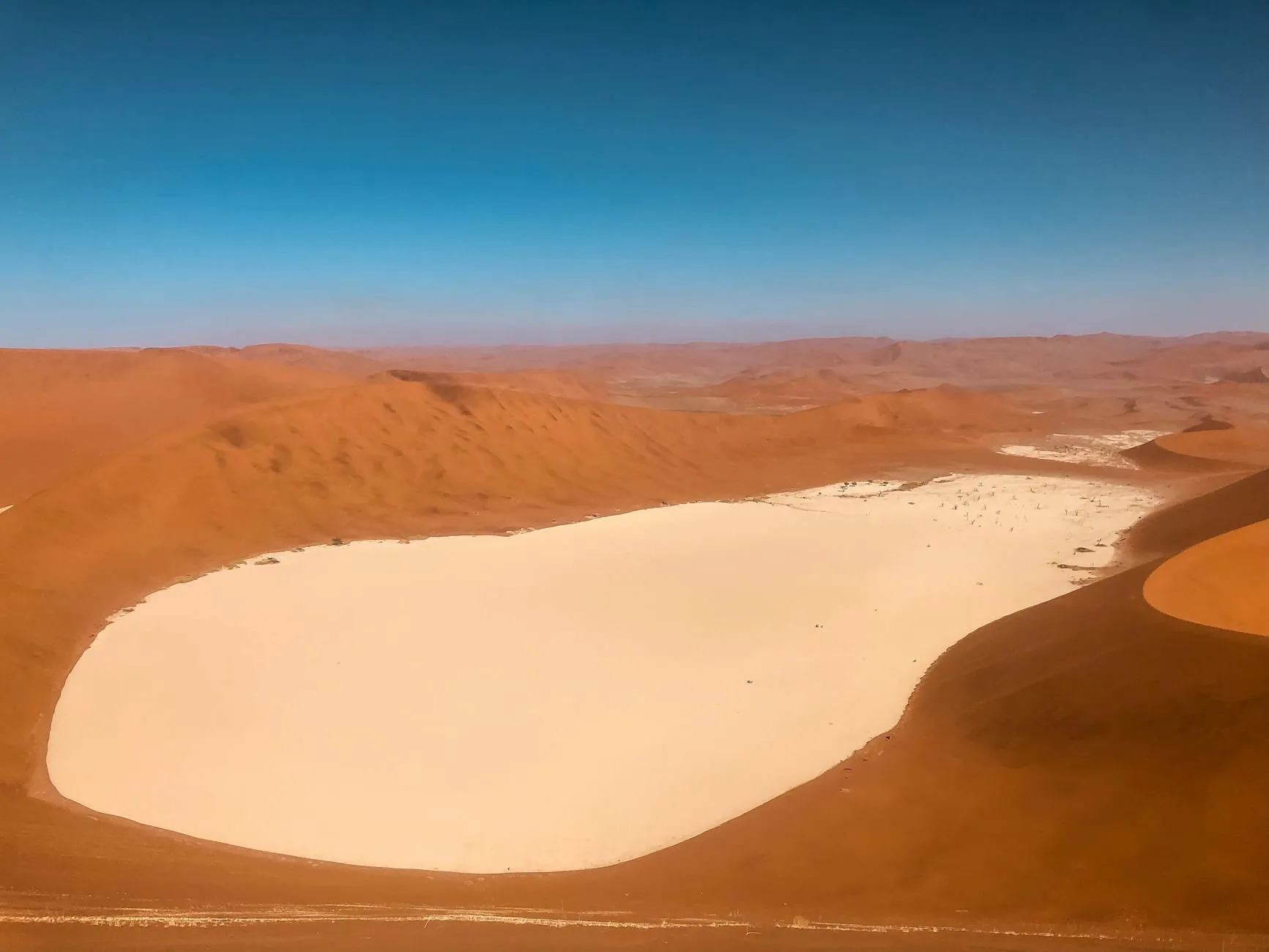
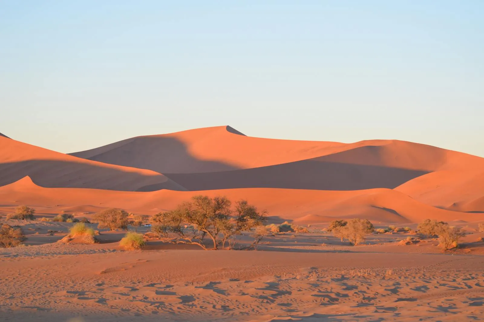
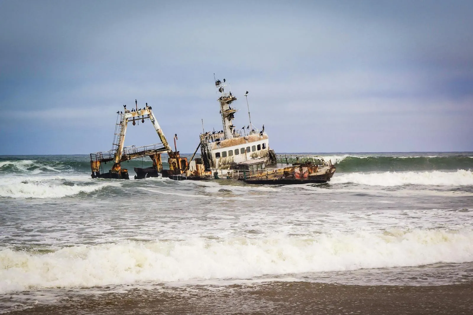
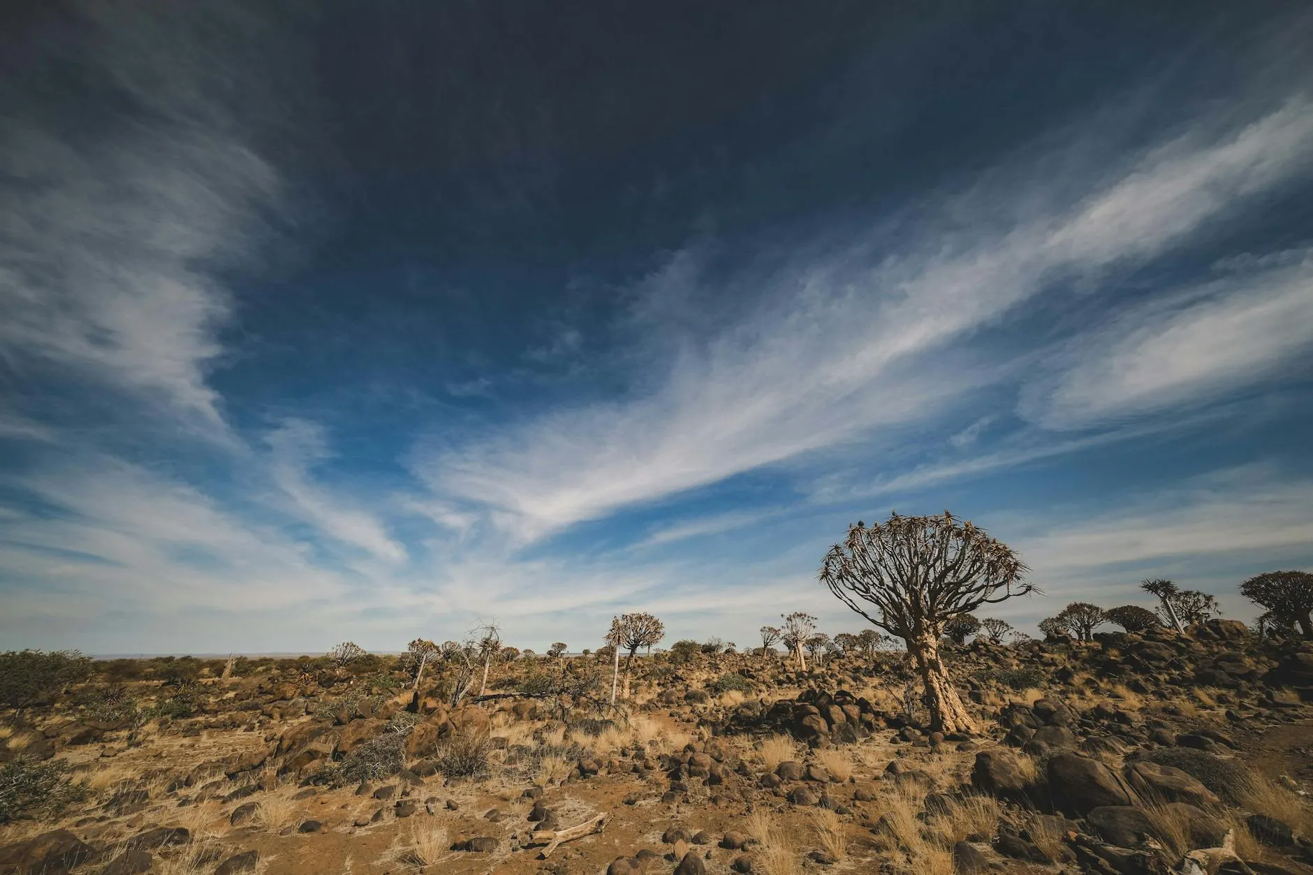
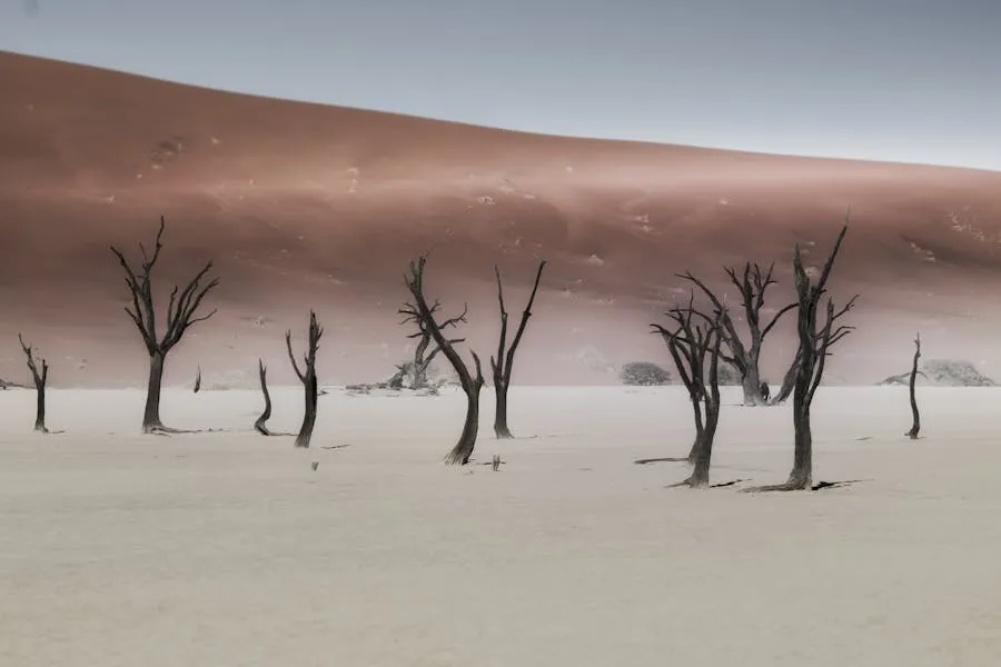
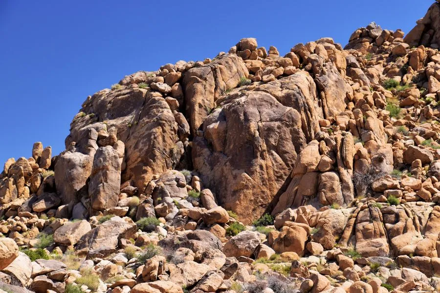
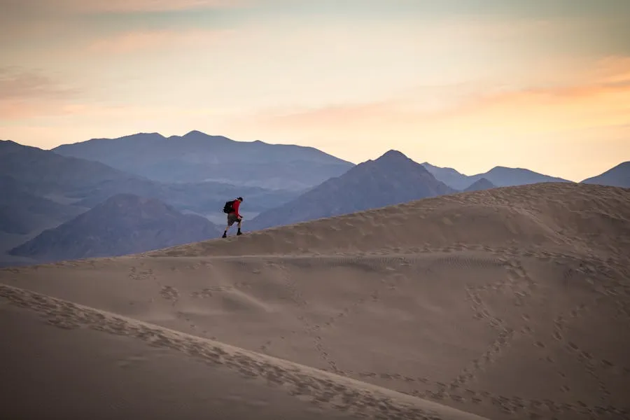
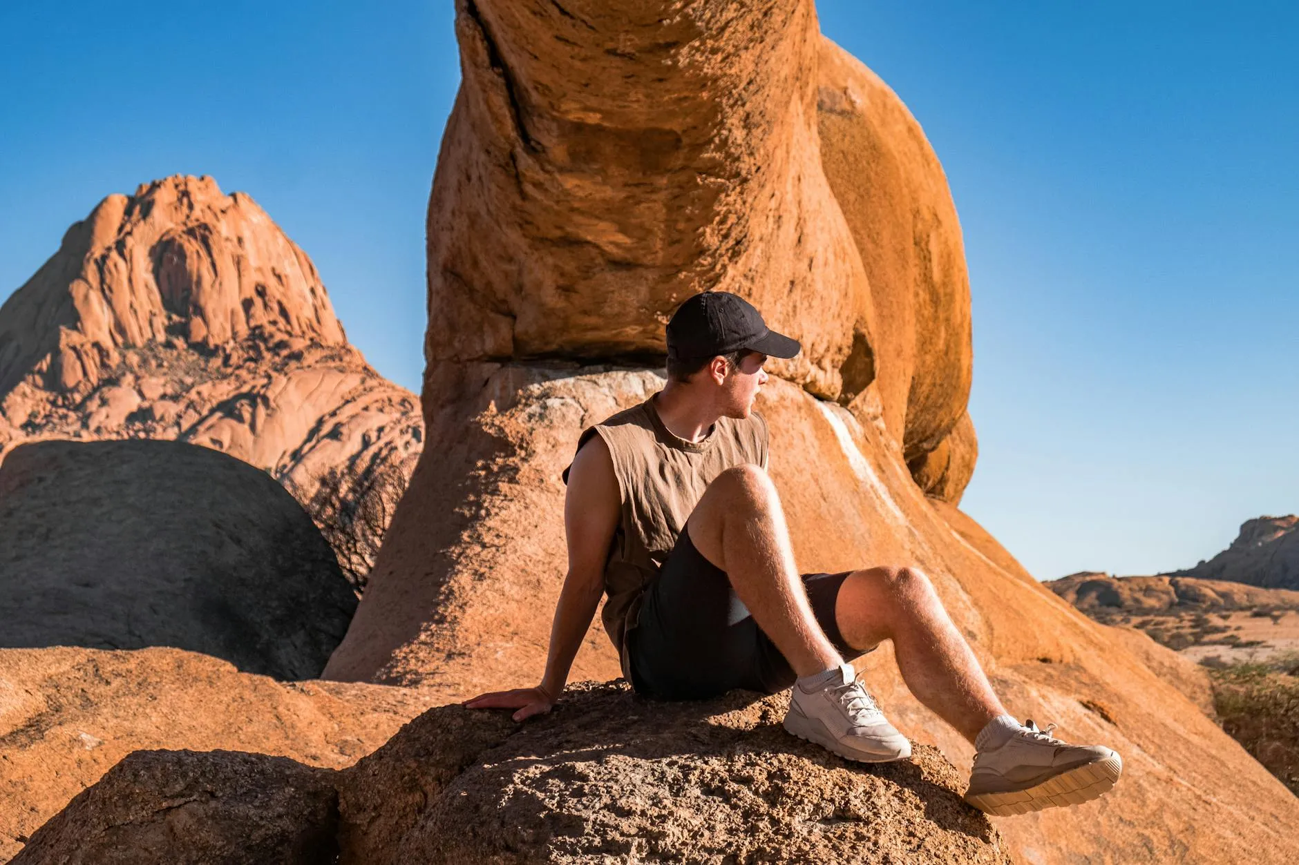
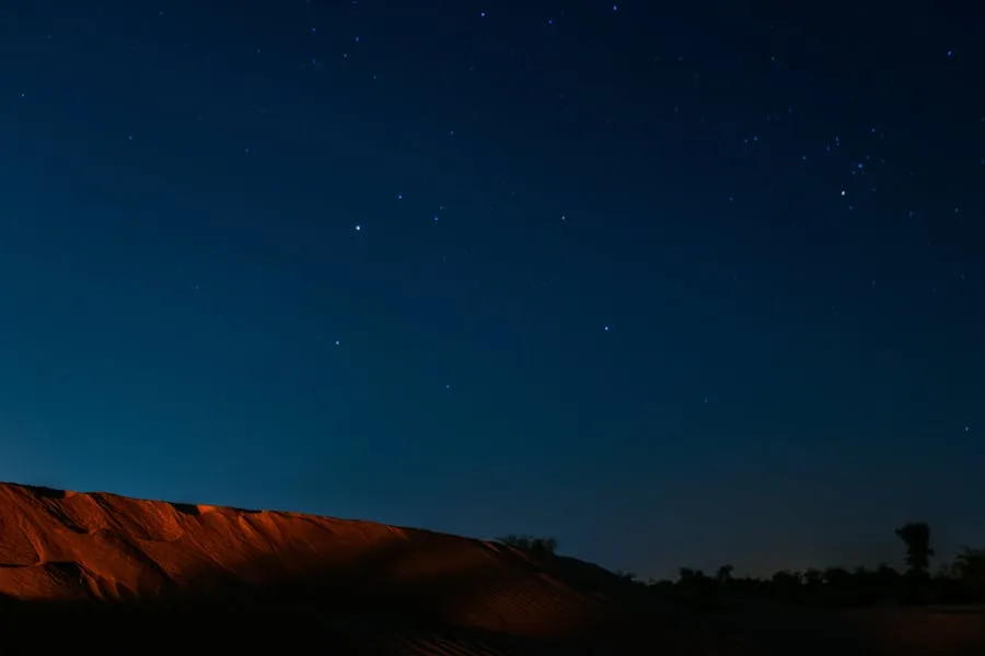
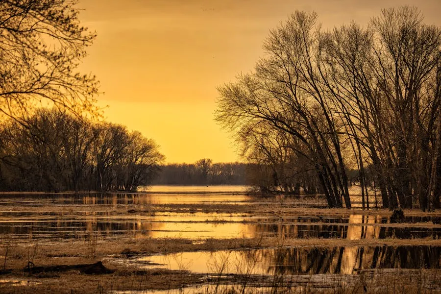
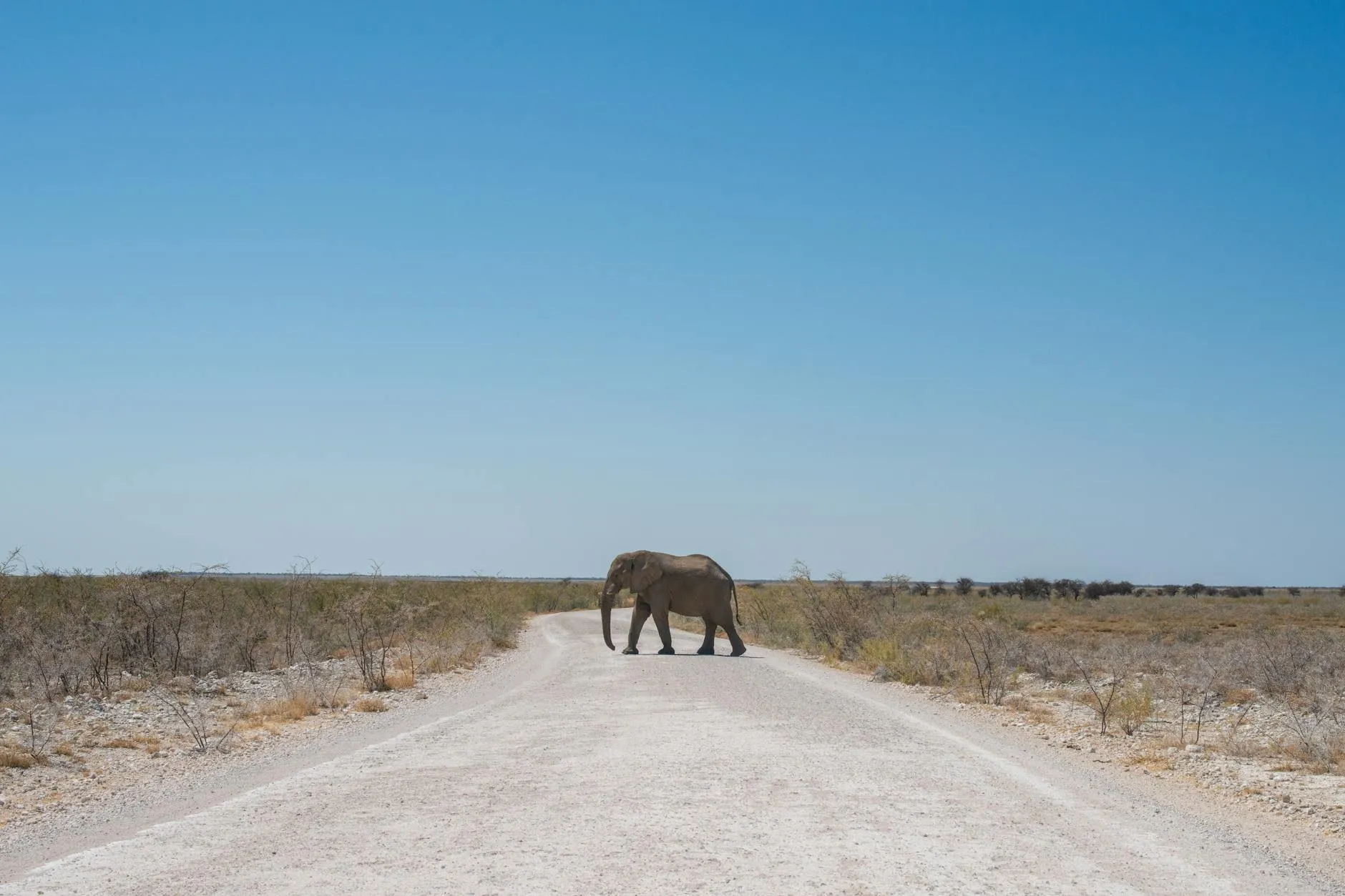
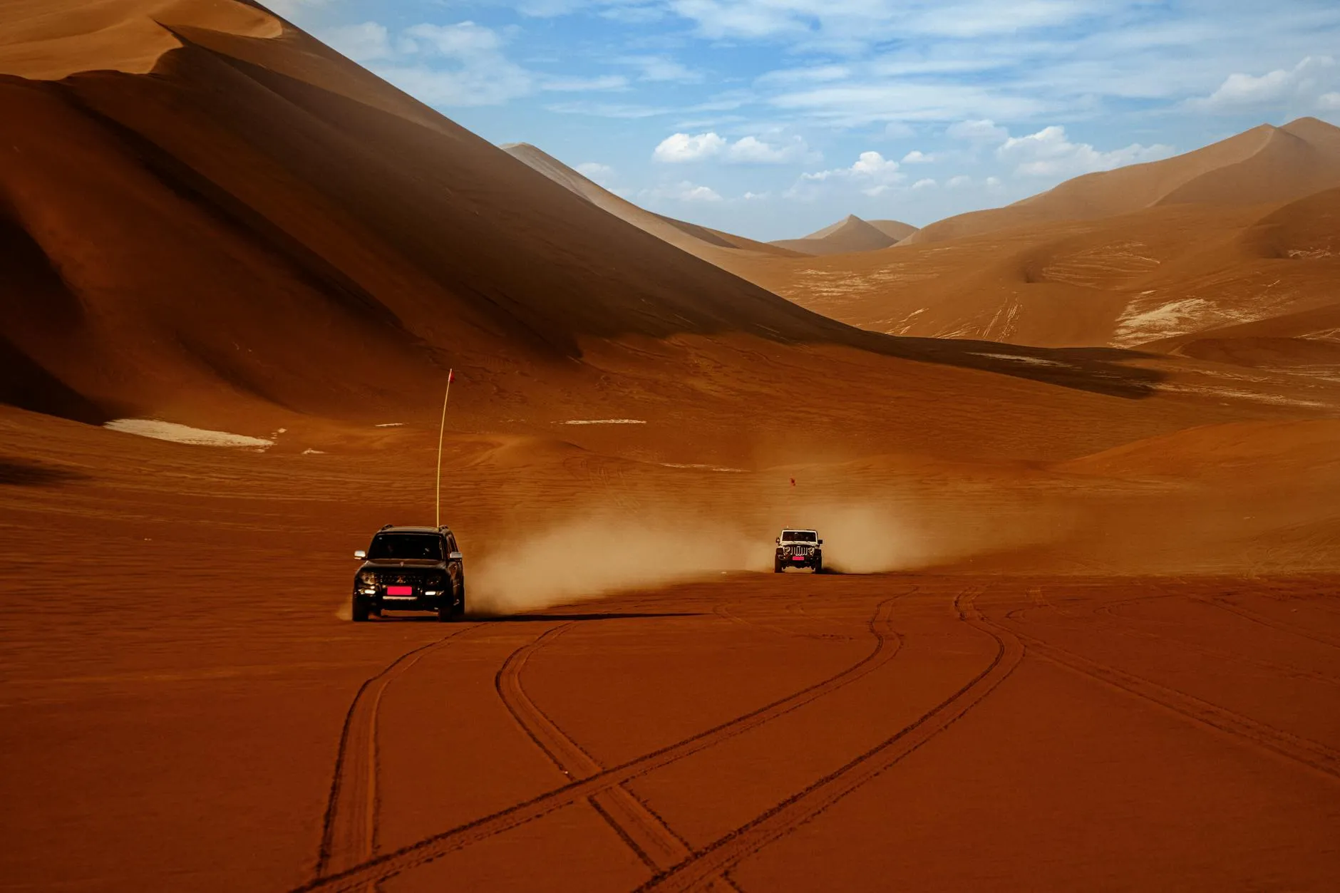
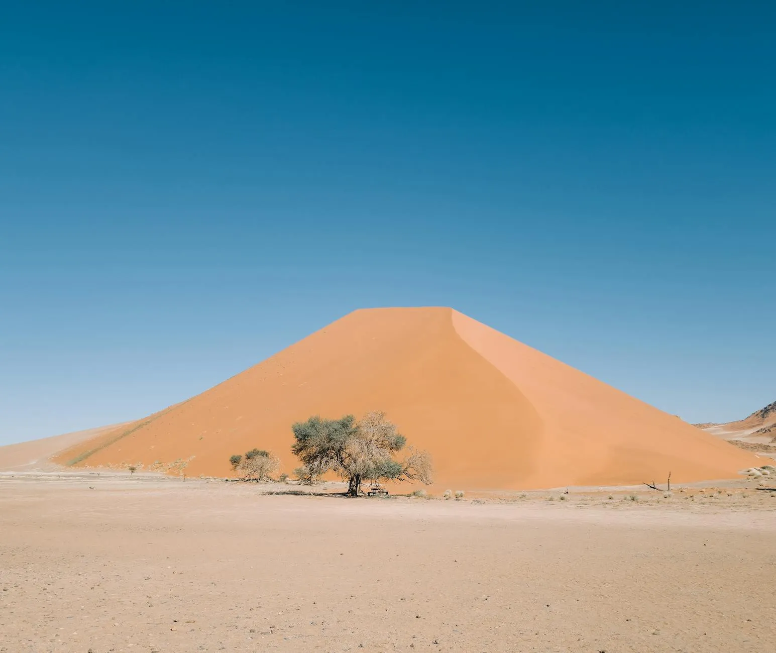
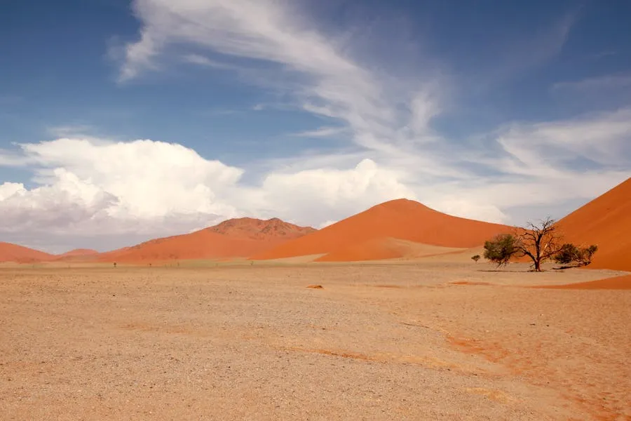
Namibia is a country of staggering emptiness and overwhelming beauty. Covering 824,292 km² (roughly twice the size of Germany) with a population of only 2.6 million people, it is the second least densely populated sovereign nation on Earth (after Mongolia). The Namib Desert, which gives the country its name, is the oldest desert on the planet, estimated at 55–80 million years old. Its apricot-red dunes at Sossusvlei rise over 300 m, making them among the tallest in the world.

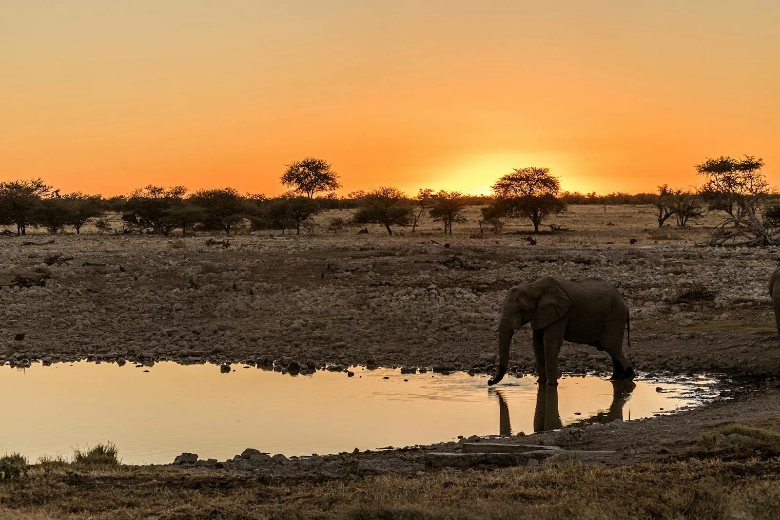
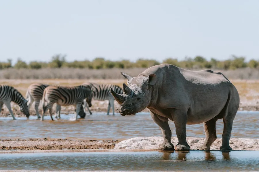
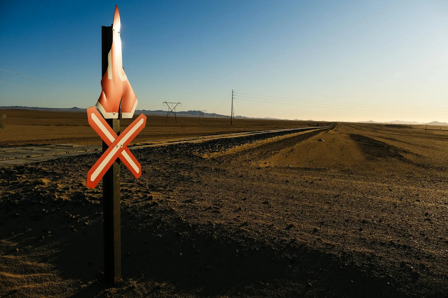
This is Africa’s great self-drive destination. Unlike most of the continent, Namibia has well-maintained gravel roads, clear signposting, virtually no traffic, and a tourism infrastructure built for independent travellers with their own vehicles. The distances are enormous and the fuel stations sparse, but that solitude is precisely the point. You can drive for hours without seeing another car, camp under skies ranked among the darkest on Earth, and encounter desert-adapted elephants and lions that exist nowhere else.

Population
~2.6M
One of the least densely populated countries on Earth (~3 people/km²)
Size
824,292 km²
Roughly 2× Germany; 1,572 km of Atlantic coastline
Currency
NAD (N$)
Namibian Dollar, pegged 1:1 to South African Rand; 1 EUR ≈ 20 NAD
Daily Budget
€50–120
Per couple, self-drive mid-range with camping and self-catering mix

Why Namibia Works for Independent Travellers

Travel Style

Self-Drive Mid-Range: Rent a 4x4 with rooftop tent or ground tent from Windhoek, follow the established gravel-road circuit through Sossusvlei, Swakopmund, Damaraland, and Etosha. Mix NWR (Namibia Wildlife Resorts) campsites, private lodges, and wild camping. Self-catering keeps costs down; guesthouse dinners provide comfort when needed.

Daily Budget: NAD 1,000–2,400 (≈ €50–120) per couple covering 4x4 rental, fuel, campsites, food, and park fees. Lodges and guided safaris push this higher.

Key Facts

  • Capital: Windhoek (1,700 m elevation)
  • Population: ~2.6 million
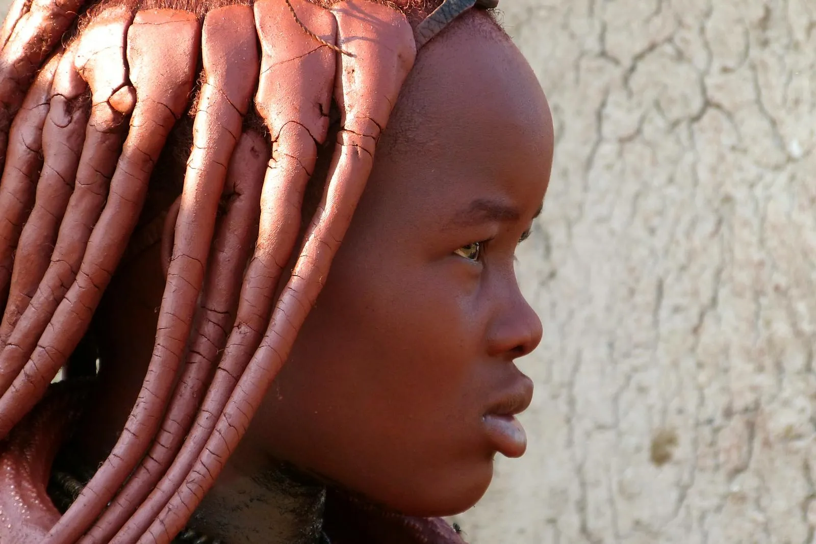
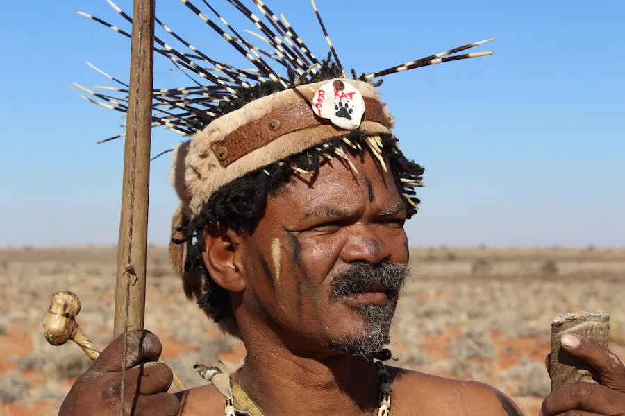
  • Languages: English (official); Oshiwambo, Afrikaans, German, Nama/Damara, Herero widely spoken
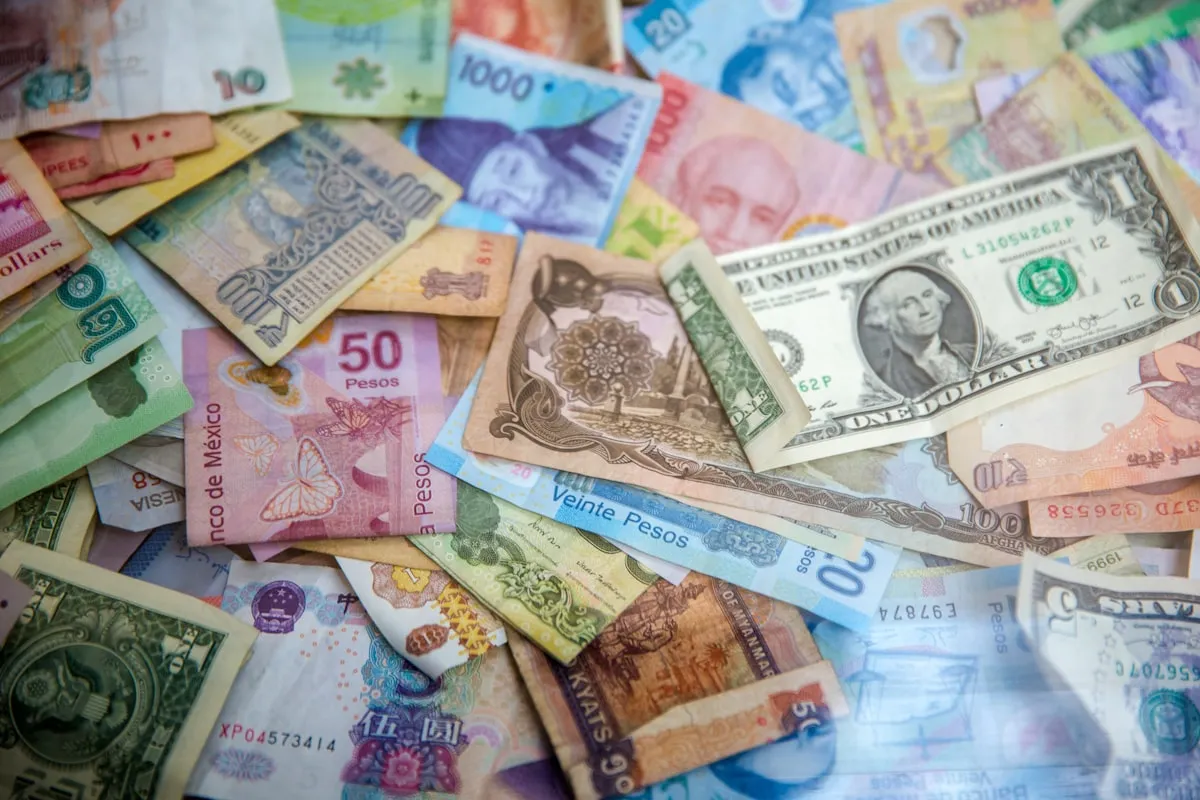
  • Currency: Namibian Dollar (NAD), pegged 1:1 to ZAR; both accepted everywhere
  • Time Zone: CAT (UTC+2, no DST)
  • Size: 824,292 km² (2× Germany)
  • Independence: 1990 (from South African administration)

Best For

  • Self-drive adventurers who love solitude and big landscapes
  • Photographers (the light, dunes, and wildlife are extraordinary)
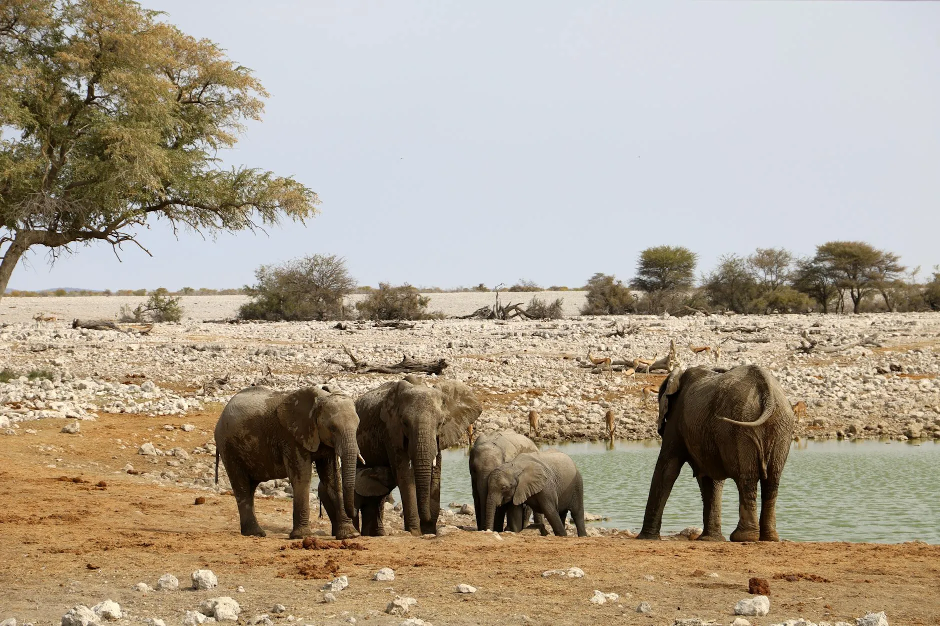
  • Safari without the East Africa price tag (Etosha is superb value)
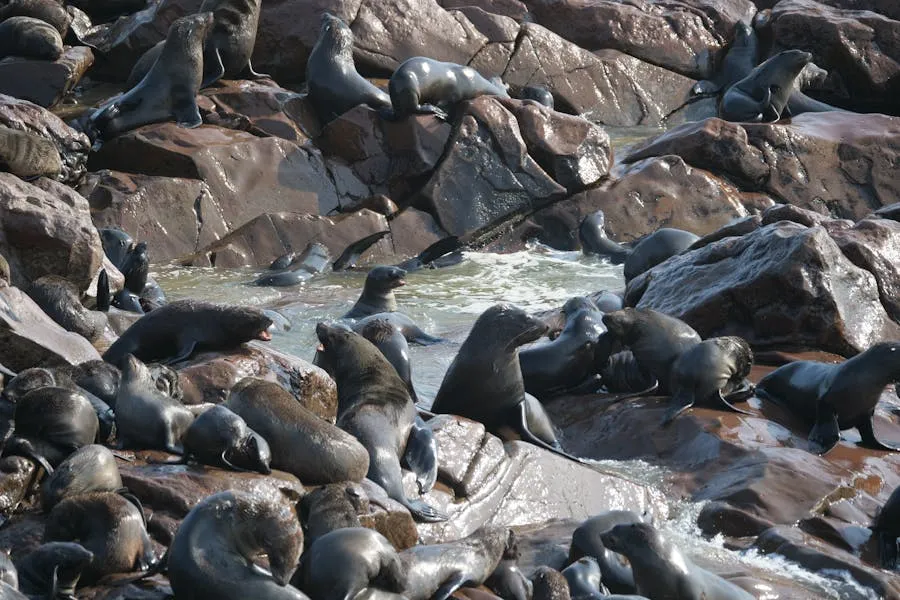
  • Desert-adapted wildlife found nowhere else (elephants, lions, rhinos)
  • Stargazing (some of the darkest skies on the planet)
  • Couples comfortable with long drives and basic camping
  • Travellers combining with South Africa or Botswana

📅 When to Go

May–Oct (dry winter). Etosha wildlife peaks Jun–Sep. Avoid Dec–Mar (extreme heat, floods in north).

✅ Self-drive advantage

Namibia is one of very few African countries where self-drive is not just possible but the standard way to travel. Roads are well-maintained, crime against tourists is rare, and the route network is straightforward. A 4x4 with rooftop tent gives complete freedom. The main loop (Windhoek–Sossusvlei–Swakopmund–Damaraland–Etosha–Windhoek) is well-established and can be done in 14 days at a comfortable pace.

Map of Namibia

A stunning sunset casting vibrant orange hues over distant desert mountains.

Namibia stretches along 1,572 km of Atlantic coastline in southwestern Africa, bordered by Angola to the north, Zambia and Botswana to the east, and South Africa to the south. The country’s geography is dominated by two deserts. The ancient Namib runs along the entire coast and the Kalahari reaches in from the east. They're separated by a central highland plateau at 1,000–2,000 m elevation where most of the population lives.

The Zambezi Region (formerly the Caprivi Strip) extends as a narrow panhandle 450 km northeast, wedged between Angola, Zambia, and Botswana, giving Namibia its only access to the Zambezi River. This single geographic quirk means Namibia touches four countries and contains ecosystems ranging from hyper-arid coastal fog desert to subtropical river floodplain. It's a diversity matched by few nations on Earth.

Map of Namibia showing major destinations, national parks and self-drive routes

The classic self-drive loop forms a rough figure-of-eight: Windhoek south to Sossusvlei (370 km, 5 hrs), west to Swakopmund on the Skeleton Coast (350 km, 4 hrs), north through Damaraland to Etosha (450 km, 5–6 hrs), and back to Windhoek (450 km, 5 hrs). Extending to the Caprivi Strip, Fish River Canyon, or the Kaokoveld adds days but rewards with emptier roads and fewer tourists.

Best Time to Visit

A stunning sunset casting vibrant orange hues over distant desert mountains.

Namibia enjoys over 300 days of sunshine per year, making it a year-round destination in principle. In practice, the best months depend on whether you prioritise wildlife viewing (dry season), comfortable temperatures (cooler months), or lush landscapes and lower prices (green season). The country’s dry winter (May–October) is peak season for good reason: clear skies, mild days, cold nights, and animals concentrated around waterholes.

May–Oct
Dry / Peak
Best wildlife viewing in Etosha; cooler temperatures; clear skies; busiest and most expensive period (Jul–Sep especially)
Nov–Dec
Shoulder
First rains begin; “green season” starts; hot (35–40 °C inland); lower prices; dramatic cloud formations for photography
Jan–Apr
Green / Low
Wet season (mostly afternoon thunderstorms); lush landscapes; bird migration; baby animals; lowest prices; some gravel roads can flood

Month-by-Month Overview

MonthSeasonBest RegionsCrowdsPricesRating
JanuaryWet / HotSossusvlei (green), Caprivi waterways🟢 Low🟢 Low⭐⭐
FebruaryWet / HotSossusvlei after rain, birdwatching🟢 Low🟢 Low⭐⭐
MarchLate WetGreen landscapes, Etosha pans fill🟢 Low🟢 Low⭐⭐⭐
AprilTransitionEtosha (game concentrating), Fish River opens🟡 Moderate🟡 Moderate⭐⭐⭐
MayDry beginsEtosha, Damaraland, Sossusvlei🟡 Moderate🟡 Moderate⭐⭐⭐⭐
JuneDry / CoolEtosha, Skeleton Coast, Fish River Canyon🟡 Moderate🟡 Moderate⭐⭐⭐⭐⭐
JulyDry / CoolEverywhere (peak wildlife, peak crowds)🔴 High🔴 High⭐⭐⭐⭐⭐
AugustDry / CoolEtosha (waterholes at best), Damaraland🔴 High🔴 High⭐⭐⭐⭐⭐
SeptemberDry / WarmingEtosha, Sossusvlei, Skeleton Coast🔴 High🔴 Peak⭐⭐⭐⭐⭐
OctoberHot / Dry endEtosha (hot but excellent game), Caprivi🟡 Moderate🟡 Moderate⭐⭐⭐⭐
NovemberEarly WetSossusvlei (storms), Skeleton Coast🟢 Low🟢 Low⭐⭐⭐
DecemberWet / HotSossusvlei, Windhoek area; holiday season🟡 Moderate🟡 Moderate⭐⭐⭐

For first-time visitors, June–September is the clearest window. Dry, cool, and the wildlife viewing in Etosha is at its best. The trade-off is higher prices and busier campsites. Book NWR accommodation 6–12 months ahead for this period. May and October offer nearly as good conditions with fewer crowds and lower prices.

⚠️ Fish River Canyon hiking season

The Fish River Canyon Trail (the 5-day, 85 km hike) is only open from 15 April to 15 September. Outside this window the canyon is closed due to extreme heat and flash-flood risk. Permits sell out months ahead. Book through NWR as early as possible.

Climate & Weather

Namibia is one of the driest countries in sub-Saharan Africa. Average annual rainfall ranges from virtually zero along the Skeleton Coast to roughly 600 mm in the Caprivi Strip. The central plateau receives 250–500 mm, mostly as dramatic afternoon thunderstorms between November and April. The Namib Desert coast is kept cool and foggy by the cold Benguela Current. Swakopmund rarely exceeds 25 °C even in summer, while Windhoek at 1,700 m bakes at 35 °C the same day.

Namib Coast (Swakopmund, Walvis Bay)
10–25°C
Cool and foggy year-round; Benguela Current keeps summers mild; winter mornings can drop to 5 °C with dense fog
Central Plateau (Windhoek, 1,700 m)
5–35°C
Hot summers (Oct–Mar) with afternoon thunderstorms; cold, dry winters with clear skies; frost possible Jun–Jul
Etosha & Northern Savanna
8–38°C
Hot and semi-arid; best game viewing in dry winter (May–Oct) when temperatures are moderate; Oct can hit 40 °C
Namib Desert Interior (Sossusvlei)
0–40°C
Extreme diurnal range; summer days above 40 °C, winter nights can drop below freezing; almost no rain
Caprivi / Zambezi Region
15–35°C
Subtropical; most rainfall in Namibia (500–700 mm); wet season floods Dec–Apr; green and lush year-round
Fish River Canyon (South)
5–42°C
Scorching in summer (hence hiking season Apr–Sep only); cold, clear winter nights; very little rain

The most important rule for Namibia is to pack for both extremes. A winter game drive at Etosha starts at 5 °C in an open vehicle and warms to 25 °C by late morning. Summer in the Namib can swing 30 °C between noon and midnight. Layers, a warm fleece, and a sun hat are all essential (in the same bag).

Seasons & Temperatures

Namibia has two broad seasons. A hot, wet summer (November–April) and a cool, dry winter (May–October). But the country’s vast size and varied geography mean conditions differ significantly between the coast, the central plateau, and the northern bushveld. The table below compares four key destinations.

MonthWindhoek °CSwakopmund °CEtosha °CSossusvlei °CBest For
Jan30 / 1722 / 1534 / 1936 / 20Green landscapes, birdwatching
Feb29 / 1723 / 1533 / 1935 / 19Photography after rains
Mar27 / 1523 / 1432 / 1733 / 17Late green season, quieter
Apr25 / 1222 / 1230 / 1430 / 14Fish River opens, transition
May22 / 820 / 1027 / 1026 / 9Dry season starts, game improving
Jun20 / 618 / 924 / 722 / 6Etosha excellent, desert cool
Jul20 / 618 / 824 / 622 / 5Peak safari, coldest nights
Aug23 / 818 / 927 / 925 / 8Warming, game still concentrated
Sep26 / 1119 / 1031 / 1330 / 12Pre-rain buildup, still dry
Oct29 / 1420 / 1134 / 1734 / 16Hot but excellent waterhole game
Nov30 / 1621 / 1334 / 1835 / 18First rains, dramatic skies
Dec31 / 1722 / 1434 / 1936 / 19Holiday period, green Etosha

The Benguela Current keeps the coast 10–15 °C cooler than the interior on any given day. Swakopmund in January (22 °C) feels like a different country to Etosha (34 °C), just 600 km away. The desert interior (Sossusvlei, the Namib-Naukluft) has the most extreme diurnal swings. Winter nights below freezing, summer days above 40 °C. If camping, a good sleeping bag rated to −5 °C is essential for the dry season.

Holidays & Festivals

Colorful holiday celebrations and festivals

Namibia observes 13 public holidays, several rooted in the liberation struggle and genocide remembrance. When a holiday falls on a Sunday, the following Monday is a day off. The most significant domestic travel period is the Christmas–New Year break (mid-December to mid-January) when South African and Namibian families flood the coast and national parks.

DateHoliday / FestivalNotes
1 JanNew Year’s DayPublic holiday. Swakopmund and the coast are packed with domestic holidaymakers
21 MarIndependence DayNamibia’s most important national holiday (independence from South Africa, 1990). Parades, speeches, and celebrations in Windhoek
Mar/AprGood Friday & Easter MondayPublic holidays. Domestic travel peaks. Etosha and Sossusvlei campsites book out
AprWIKA KarnevalWindhoek’s German-influenced carnival. Costume parades, beer tents, and brass bands. A remnant of colonial-era traditions
1 MayWorkers’ DayPublic holiday
4 MayCassinga DayCommemorates the 1978 attack on a SWAPO refugee camp in Angola. Solemn memorial events
25 MayAfrica DayPublic holiday celebrating African unity
28 MayGenocide Remembrance DayRemembers the 1904–1908 genocide of the Herero and Nama peoples by German colonial forces. A day of sombre reflection
26 AugHeroes’ DayHonours those who fought for independence. Long weekend; moderate domestic travel
SepAi-Ais Richtersveld FestivalCultural festival at the Fish River Canyon area. Music, food, and community events
OctWindhoek OktoberfestGerman beer festival tradition alive and well; Windhoek’s largest social event. Tafel Lager and Windhoek Draught flow freely
10 DecHuman Rights DayPublic holiday. Also marks International Human Rights Day
25 DecChristmas DayPublic holiday. Summer Christmas; braais and beach trips
26 DecFamily DayPublic holiday
⚠️ Booking pressure periods

NWR (Namibia Wildlife Resorts) campsites and rest camps inside Etosha and other national parks book out 6–12 months ahead for the July–September dry season and the December–January holiday period. Private lodges are similarly constrained. If you can’t book NWR online, call them directly. The website is unreliable but phone bookings work.

Regions of Namibia

Aerial view of the Namibian landscape with red desert dunes

Namibia offers diverse landscapes and experiences across its regions.

Central Namibia & Windhoek landscape

Central Namibia & Windhoek

Most trips start and end in Windhoek, the compact capital at 1,700 m on the central plateau. It's a small city by any measure (~430,000 people) with a curious blend of German colonial architecture, modern African energy, and township sprawl on the outskirts. Plan a day at the start and a day at the end.

Southern Namibia landscape

Southern Namibia

Southern Namibia holds the country's two most iconic landscapes. The towering red dunes of Sossusvlei and the vast Fish River Canyon. This is the driest part of an already dry country.

Skeleton Coast & Swakopmund landscape

Skeleton Coast & Swakopmund

Namibia's Atlantic coastline is one of the most inhospitable and hauntingly beautiful stretches of shore in the world. The cold Benguela Current creates dense fog banks that roll inland over the dunes, reducing visibility to metres and creating an otherworldly atmosphere. The Skeleton Coast gets its name from the whale bones and shipwrecks that ...

Etosha & the North landscape

Etosha & the North

Northern Namibia is where the big wildlife lives. Etosha National Park is the country's premier game reserve, one of Africa's finest and most accessible safari destinations. West of Etosha, Damaraland offers a completely different experience.

Zambezi Region (Caprivi Strip) landscape

Zambezi Region (Caprivi Strip)

The Zambezi Region is Namibia's green surprise, a 450 km-long panhandle stretching northeast between Angola, Zambia, and Botswana, with more water, more vegetation, and more wildlife density than the rest of the country combined. It feels like a different country entirely. Instead of desert and dunes, you get rivers, floodplains, and tropical wo...

Damaraland & Kunene

The rugged northwest between Etosha and the Skeleton Coast is home to desert-adapted elephants, rhinos, and ancient rock engravings at Twyfelfontein (UNESCO). Red sandstone, granite outcrops, and the surreal Organ Pipes. Community conservancies offer authentic wildlife encounters without the crowds.

Top Sightseeing

Explore the majestic rock formations of Spitzkoppe under clear blue skies in Namibia's Erongo region.

Namibia’s sightseeing is landscape-driven rather than monument-driven. The country has relatively few museums or built attractions; instead, the sights are geological, ecological, and astronomical. The emptiness itself is the attraction — vast skies, ancient deserts, and wildlife adapted to one of the harshest environments on earth.

  • Sossusvlei & Namib Desert: Towering red dunes reaching 300 m, the surreal white clay pan of Deadvlei, and desert-adapted elephants in the world’s oldest desert
  • Etosha National Park: One of Africa’s great game reserves — Big Five gathering at floodlit waterholes during the dry season
  • Fish River Canyon: The world’s second-largest canyon — an 85 km, 5-day hiking trail through 500 million years of geological time
  • Skeleton Coast: Shipwrecks, Cape fur seal colonies, and fog-shrouded desert meeting the Atlantic in one of the loneliest coastlines on earth
  • Twyfelfontein: UNESCO-listed rock engravings up to 6,000 years old, plus desert rhino tracking and the granite spires of Spitzkoppe
Dead camelthorn trees in Deadvlei

Deadvlei & Sossusvlei

The white clay pan of Deadvlei, surrounded by 300 m rust-red dunes and scattered with 900-year-old dead trees, is one of the most photographed landscapes on Earth. Arrive at sunrise when the low light paints the dunes in layers of orange, red, and shadow.

Rhinos at an Etosha waterhole

Etosha Waterholes

The floodlit waterholes at Okaukuejo and Halali rest camps offer front-row seats to Africa’s wildlife. Black rhinos are almost guaranteed at Okaukuejo after dark. Sit quietly, let the animals come to you. The patience is rewarded every time.

Fish River Canyon panorama

Fish River Canyon

The second-largest canyon in the world. 160 km long, 550 m deep. The viewpoints along the eastern rim are free with park entry and offer vertigo-inducing vistas. The 5-day hiking trail along the canyon floor is one of Africa’s great treks.

Sand-filled rooms in Kolmanskop ghost town

Kolmanskop Ghost Town

An abandoned German diamond-mining town being swallowed by the Namib Desert. Sand pours through doorways, fills bathtubs, and climbs walls. The morning light creates extraordinary photographs. Guided tours only, NAD 110 (≈ €5.50).

Ancient rock engravings at Twyfelfontein

Twyfelfontein (UNESCO)

Over 2,500 rock engravings carved by San hunter-gatherers up to 6,000 years ago. Depictions of elephants, rhinos, giraffes, and animal tracks spread across sandstone slabs. Africa’s largest concentration of petroglyphs. Guided walks only.

Thousands of Cape fur seals at Cape Cross

Cape Cross Seal Colony

Up to 200,000 Cape fur seals crammed onto a rocky stretch of Skeleton Coast. The noise and smell are overwhelming, and the experience is unforgettable. Breeding season (Nov–Dec) is the most dramatic.

Spitzkoppe granite peaks at sunset

Spitzkoppe

A group of granite inselbergs rising 1,784 m from the flat desert plain. The “Matterhorn of Namibia.” Superb rock climbing, hiking, San rock art, and some of Namibia’s best wild camping. The star photography here is extraordinary.

Quiver tree forest at sunset

Quiver Tree Forest

A grove of ~250 Aloe dichotoma near Keetmanshoop in southern Namibia, some over 300 years old. The trees were used by San hunters to make arrow quivers. Best at sunset when the bark glows golden. Nearby Giant’s Playground has bizarre dolerite rock formations.

Climbing Dune 45 at sunrise

Dune 45

The most climbed dune in Namibia. 170 m tall, perfectly shaped, and positioned exactly 45 km from the Sesriem gate. The sunrise climb (30–45 minutes) is a rite of passage. The ridgeline walk with views over the Namib is unforgettable.

Dunes meeting the ocean at Sandwich Harbour

Sandwich Harbour

Where the Namib dunes plunge directly into the Atlantic. A landscape so dramatic it feels digital. Only accessible by guided 4x4 tour from Walvis Bay (NAD 1,500–2,500 (≈ €75–125) pp). The tidal timing is critical; the route floods at high tide.

Culture & Cuisine

Himba women in traditional dress

Namibia’s cultural landscape reflects layers of history: indigenous San, Bantu-speaking groups (Ovambo, Herero, Nama, Damara, Kavango), German colonialism (1884–1915), South African administration (1915–1990), and post-independence nation-building. English is the official language but Oshiwambo (spoken by ~50% of the population), Afrikaans (the de facto language of commerce and everyday life), and German are more commonly heard.

  • Herero & Nama genocide: Between 1904 and 1908, German colonial forces killed an estimated 65,000 Herero and 10,000 Nama people in what is now recognised as the first genocide of the 20th century. Germany formally acknowledged this in 2021. The history is raw and important. The Independence Memorial Museum in Windhoek provides essential context.
  • Himba people: The semi-nomadic Himba in the Kaokoveld are often described as one of Africa’s last truly traditional cultures. Women cover their skin and hair with otjize (red ochre and butterfat). Visits to Himba villages are possible but should be done through community-approved guides, not through tour operators who treat villages as a zoo. Ask before photographing; compensation (cash, food staples) is expected and appropriate.
  • Ovambo culture: The Ovambo people make up roughly half of Namibia’s population and dominate the northern regions. The Ovambo homestead (egumbo) is a fenced compound with multiple huts and a mahango (millet) store. Political leadership since independence has been predominantly Ovambo (SWAPO party).
  • German influence: Namibia has a significant German-speaking minority (~25,000 people), concentrated in Windhoek, Swakopmund, and farming areas. German architecture, Oktoberfest, Black Forest cake, and Konditoreien (pastry shops) are genuine parts of everyday life, not tourist gimmicks. The relationship between this community and indigenous Namibians is complex and evolving.
  • Greetings: A handshake is standard. In rural areas, take time with greetings. Ask about health, family, and cattle (in pastoral communities) before getting to business. Rushing straight to a question is considered rude.
  • Tipping: NAD 20–50 per person per activity for guides and trackers. NAD 10–20 per night for campsite/lodge staff. Restaurant tips 10–15% if not included.
  • Photography: Always ask before photographing people, especially in rural and traditional communities. A small payment or gift is normal and fair. Photographing government buildings, military installations, and some border areas is prohibited.

Food & Cuisine

Namibian cuisine is meat-heavy, braai-centred, and influenced by German, South African, and indigenous traditions. The country is not a foodie destination in the way South Africa or Morocco are, but the game meats are excellent, the German bakeries are a genuine surprise, and the braai (barbecue) culture around a campfire under the Milky Way is one of the great pleasures of a Namibia trip.

Signature dishes & foods

  • Game meat: Oryx (gemsbok), kudu, springbok, and ostrich are staples. Oryx steak is lean, flavourful, and widely available at lodges and restaurants for NAD 120–250 (≈ €6–12.50). Biltong (dried, cured meat) and droewors (dried sausage) are the road-trip snacks.
  • Braai: The campfire barbecue is the national social institution. Boerewors (coiled beef sausage), chops, and steak grilled over mopane wood. Every campsite has braai stands; supermarkets sell pre-marinated braai packs.
  • Kapana: Informal open-fire grilled beef sold at street markets and townships. The Katutura kapana market in Windhoek is the authentic experience. Choose your meat, it’s grilled to order, served with chilli relish. NAD 30–60 (≈ €1.50–3).
  • Potjiekos: A slow-cooked stew made in a three-legged cast-iron pot over coals. Lamb, vegetables, and gravy cooked for hours. A campfire classic.
  • Oshifima (pap): The staple of northern Namibia. Stiff mahango (pearl millet) porridge eaten with meat, fish, or vegetable sauce. The Ovambo everyday meal.
  • German bakeries: Swakopmund and Windhoek have excellent Bäckereien producing Apfelstrudel, Schwarzwälder Kirschtorte (Black Forest cake), Brezeln (pretzels), and sourdough bread. Café Anton in Swakopmund is the classic. NAD 40–80 (≈ €2–4) for pastries.
  • Oysters: Walvis Bay farm-raised oysters are superb. The cold Benguela Current produces fat, briny Pacific oysters. NAD 15–25 (≈ €0.75–1.25) each at waterfront restaurants. Some of the cheapest quality oysters in the world.

Drinks

  • Windhoek Lager / Draught: Namibia’s national beer, brewed under the German Reinheitsgebot (purity law). Genuinely good. NAD 25–50 (≈ €1.25–2.50) in a bar.
  • Tafel Lager: The everyday alternative. Lighter, cheaper, and found in every cuca shop (informal bar) in the country.
  • Oshikundu: A traditional fermented mahango drink from northern Namibia. Thick, slightly sour, mildly alcoholic. An acquired taste for visitors but culturally significant.
  • Amarula: Cream liqueur made from the marula fruit. Sweet and popular as a sundowner.
  • Water: Tap water in Windhoek and Swakopmund is safe to drink. Elsewhere, carry bottled or filtered water. In the desert, plan for 3–4 litres per person per day minimum.
✅ Self-catering on a road trip

Stock up at Shoprite, Checkers, or Spar in Windhoek before heading out. Once you leave the capital, supermarket options shrink fast. Petrol station shops in small towns carry basics but at inflated prices. Bring a cooler box, braai supplies, and enough dry goods for your longest stretch between towns.

Activities & Hikes

A man relaxes on sunlit rocks at Spitzkoppe, Namibia's striking mountain range.

Namibia is not a hiking destination in the Alps-or-Andes sense. The heat, distances, and lack of water make extended backcountry hiking impossible in most regions. But it has a few standout treks and numerous shorter walks that use the landscape’s drama to full effect.

Top Hikes

HikeLocationDifficulty & LengthHighlights
Fish River Canyon TrailAfrica’s85 km, 5 daysOne of Africa’s great multi-day hikes. Follow the river through the second-largest canyon on Earth, camping on sandy riverbanks, passing hot springs, and scrambling over boulders. Open 15 April–15 September only (extreme heat and flash floods otherwise). Requires a medical certificate of fitness. No guides needed but a group of 3+ is mandatory. Permits from NWR; book well ahead. Finishes at Ai-Ais Hot Springs.
Tok Tokkie TrailNamibRand Nature ReserveModerate – 3 daysA guided walk through the NamibRand Nature Reserve with sleep-outs under the stars on camp beds in the open desert. The stargazing alone is worth the price (NAD 5,000–7,000 (≈ €250–350) pp all-inclusive). Moderate fitness required. One of the most unique overnight hiking experiences in Africa.
Waterberg Plateauday hikes and multi-dayA flat-topped sandstone plateau rising 200 m above the bushveld. Well-marked day trails through montane forest with rhinos, sable antelope, and Cape vultures. The 4-day unguided Waterberg Wilderness Trail is the longest option. NWR campsites at the base.
Spitzkoppeday hikesScramble around the granite inselbergs, visit San rock-art sites (including “Bushman’s Paradise”), and climb to the arch for sunset views. No marked trails. Explore at your own pace. Wild camping in designated areas.
Dune 45 & Big Daddyhalf dayClimbing Dune 45 (170 m) at sunrise is a 30–45 minute sand slog. Big Daddy (300+ m) is a harder, 60–90 minute climb from the Deadvlei side. Both reward with extraordinary desert panoramas.
Naukluft MountainsNamib120 km, 4–7 hoursThe Naukluft section of the Namib-Naukluft Park has several marked day trails (4–7 hours) and an 8-day, 120 km circular trail through rugged mountain terrain. Less visited than Fish River Canyon; permits from NWR.
Brandberghalf day3–4 hoursGuided hike to the “White Lady” rock painting (actually a male figure, the name stuck from an early misidentification). 3–4 hours return through a rocky riverbed. Guides mandatory. NAD 150 (≈ €7.50).

Activities

Namibia is one of the driest countries in Africa, but its coastline and the Zambezi Region offer a handful of memorable water-based experiences. These are not the primary reason to visit, but they make excellent add-ons to a desert-focused itinerary.

  • Kayaking with seals, Walvis Bay: The signature water activity in Namibia. Paddle through Walvis Bay lagoon alongside Cape fur seals, pelicans, and flamingos, with dunes rising behind. Half-day tours NAD 800–1,200 (≈ €40–60). Dolphins and the occasional sunfish are common. Go morning for calmer water.
  • Dolphin & whale boat cruises, Walvis Bay: Catamaran cruises through the bay with seal encounters, oysters, and sparkling wine. Heaviside’s dolphins (endemic to the Benguela system) are regularly sighted. NAD 800–1,500 (≈ €40–75). Whale season: Jul–Nov (southern right whales).
  • Fishing, Skeleton Coast: Shore-based angling for kabeljou (kob), steenbras, and galjoen along the Skeleton Coast. Henties Bay and Terrace Bay are popular. Permits required (NAD 25/day from NWR). The coast is wild and empty. Fishing here is as much about solitude as sport.
  • Mokoro (dugout canoe), Zambezi Region: Paddle traditional dugout canoes through the Okavango panhandle waterways in the Caprivi Strip. Hippos, crocodiles, and birdlife. A quieter, cheaper alternative to Botswana’s Okavango Delta.
  • White-water rafting, Kunene River: Multi-day expeditions on the border river between Namibia and Angola. Remote, challenging, and rarely done. This is serious wilderness rafting for experienced paddlers. Specialist operators only.

Off the Beaten Path

NamibRand Nature Reserve starscape

NamibRand Nature Reserve

A 215,000-hectare private reserve and Africa’s first International Dark Sky Reserve. The stargazing is world-class. Zero light pollution, high altitude, dry air. The Tok Tokkie Trail sleep-outs and Sossusvlei Desert Lodge’s private observatory are the highlights.

Dunes meeting the ocean at Sandwich Harbour

Sandwich Harbour

Towering dunes plunge directly into the Atlantic at this remote wetland south of Walvis Bay. Only accessible by guided 4x4 at low tide. The scale (300 m dunes meeting the ocean) is genuinely surreal. Flamingos and pelicans feed in the lagoon.

Desert landscape in Palmwag Concession

Palmwag Concession

A vast community conservancy between Damaraland and the Skeleton Coast. Desert-adapted elephants, black rhinos tracked on foot, brown hyena, and the Hoarusib River desert lions. Accommodation ranges from basic campsites to luxury lodges. The emptiness is the attraction.

Colourful German colonial buildings in Lüderitz

Lüderitz & Dias Point

This windswept Atlantic town feels frozen in German colonial time. Pastel Art Nouveau buildings, a Gothic church, and the most remote coffee shops in Namibia. Dias Point has penguins, flamingos, and a replica of the Portuguese cross planted by Bartolomeu Dias in 1488.

Sunset over the Okavango panhandle in the Zambezi Region

Mahango Core Area

Bwabwata National Park’s gem: a 25,000-hectare floodplain on the Okavango River in the Caprivi Strip. Buffalo, hippos, elephants, crocodiles, roan antelope, and hundreds of bird species. Free self-drive; basic campsite. Virtually no other tourists.

San Bushmen in Nyae Nyae Conservancy

Nyae Nyae Conservancy

Home to one of the last San (Bushman) communities still practising traditional hunting and gathering. Multi-day cultural immersion experiences through the Tsumkwe Lodge. Walking with trackers, learning plant medicine, making fire by friction. Raw, respectful, and deeply meaningful.

Wildlife & Nature

Group of African elephants drinking at a waterhole in the savanna with surrounding landscape.

Namibia is one of Africa’s great wildlife countries, not for the density of East Africa’s Serengeti, but for the extraordinary adaptations of animals that survive in one of the harshest environments on Earth. The country pioneered community-based conservation in Africa, giving local communities ownership of wildlife on their land. The result is that Namibia is the only country in Africa where large wildlife populations have increased consistently since independence.

  • The Big Four: Namibia has lion, leopard, elephant, and rhino (both black and white) but no reliable buffalo population outside the Caprivi Strip. Hence “Big Four,” not Big Five. Etosha is the best place to see them, particularly black rhino. The park has one of the largest populations in Africa.
  • Desert-adapted elephants: Found in the dry riverbeds of Damaraland and the Kaokoveld. These are not a separate species but a behavioural adaptation. They travel vast distances between water sources, have larger feet and slimmer bodies, and are tracked by community rangers. Seeing a herd walking through a bone-dry riverbed is one of Namibia’s most unforgettable experiences.
  • Desert-adapted lions: The Skeleton Coast and Kunene River lions hunt Cape fur seals, oryx, and springbok in the Namib Desert. Once nearly extinct, their numbers have recovered thanks to conservation efforts. Sightings are rare but the Hoanib and Hoarusib riverbeds are the best areas.
  • Black rhino: Namibia holds about one-third of the world’s remaining black rhinos. Etosha, Damaraland (tracked on foot with guides), and private reserves offer sighting opportunities. Community conservancies run rhino-tracking experiences. The proceeds fund anti-poaching patrols.
  • Cheetah: Namibia has the world’s largest cheetah population (~1,500). Most live on commercial farmland, not in parks. The AfriCat Foundation near Otjiwarongo and the Cheetah Conservation Fund at Otjiwarongo offer educational visits.
  • Cape fur seals: Cape Cross hosts up to 200,000 seals. Pelican Point at Walvis Bay is another colony. Breeding season (Nov–Dec) is the most dramatic period.
  • Birdlife: Over 650 species recorded. The Caprivi Strip is the birding hotspot (African fish eagle, Pel’s fishing owl, African skimmer). The Namib coast hosts Damara tern (endemic), flamingos, and pelicans. Etosha has large raptor populations.
  • Unique desert fauna: The Namib Desert harbours the fog-basking beetle (Stenocara gracilipes), which collects water from morning fog on its body; the sidewinding adder (Bitis peringueyi); and the Namib golden mole, which “swims” through sand.
✅ Community conservancies

Namibia’s 86 communal conservancies cover over 166,000 km², roughly 20% of the country. They give rural communities legal rights to manage and benefit from wildlife. Staying at conservancy-run lodges and camps directly funds conservation and community development. The Torra, Palmwag, and Anabeb conservancies in Damaraland are among the most successful.

Route A: Classic 2-Week Self-Drive

Empty desert railroad scene with a warning sign, clear sky, and distant mountains.

The standard Namibia circuit and the route most first-timers should follow. A loop from Windhoek covering the country’s four headline destinations: Sossusvlei, Swakopmund, Damaraland, and Etosha. All on paved or well-maintained gravel roads. A 4x4 is recommended but a high-clearance 2WD can handle most of it (except the last 5 km to Deadvlei).

Total distance: ~2,200 km • Driving days: 7 of 14 • Vehicle: 4x4 with rooftop tent recommended

Day-by-day itinerary

Day 1: Arrive Windhoek

Arrive at Hosea Kutako International Airport. Collect 4x4 rental (book well ahead for Jul–Sep). Stock up at Shoprite/Checkers. Overnight in Windhoek. The Chameleon Backpackers or Urban Camp for budget, AM Weinberg Boutique Hotel for mid-range.

Day 2: Windhoek → Sesriem / Sossusvlei area (370 km, 5 hrs)

Early departure south on the B1, then west on the C24/C19. Flat tarred road gives way to good gravel. Arrive at your lodge or campsite outside Sesriem Gate. Explore Sesriem Canyon in the late afternoon. Braai dinner under the stars.

Day 3: Sossusvlei & Deadvlei

Enter at gate opening (sunrise). Drive to Dune 45 for the sunrise climb (30–45 min). Continue to the 2x4 car park, then 4x4 shuttle or walk to Deadvlei (1 hr on foot). Climb Big Daddy if energy allows. Return to camp for afternoon rest. Sesriem Canyon sunset walk.

Day 4: Sossusvlei → Swakopmund (350 km, 4–5 hrs)

Drive northwest via the Gaub and Kuiseb Passes through stunning geological transitions. Mountains give way to gravel plains, then to the coastal Namib. The temperature drops 15 °C as you approach the Atlantic. Arrive Swakopmund. Check in to a guesthouse or backpackers.

Day 5: Swakopmund

Adventure day: sandboarding on the dunes, quad biking, or skydiving in the morning. Afternoon at the museum, German bakery coffee, and a waterfront walk. Optional: Walvis Bay seal kayaking tour. Evening: fresh oysters at The Tug or Jetty 1905.

Day 6: Swakopmund → Cape Cross → Damaraland (350 km, 5 hrs)

Drive north along the salt road to Cape Cross Seal Colony (1 hour stop). Continue inland through the Skeleton Coast landscape to Twyfelfontein area. Camp at Aba-Huab or a Damaraland lodge.

Day 7: Damaraland

Morning: Twyfelfontein rock engravings (guided walk, 1.5 hrs). Drive to Burnt Mountain and the Organ Pipes (basalt columns). Afternoon: desert-adapted elephant tracking with a community guide in the Huab riverbed. Sundowner with a view of the Damaraland moonscape.

Day 8: Damaraland → Etosha (300 km, 4 hrs)

Drive northeast to Etosha via the C35/C38. Enter through Anderson Gate (western entrance). Check in at Okaukuejo rest camp. Afternoon game drive along the waterholes. Evening sit at the floodlit Okaukuejo waterhole. Rhinos, elephants, and lions are regular visitors.

Day 9: Etosha (Okaukuejo area)

Full day of self-drive game viewing. Sunrise drive to the Etosha Pan lookout points (Salvadora, Olifantsbad, Gemsbokvlakte). Return to camp for midday rest. Afternoon drive to different waterholes. Evening waterhole watch.

Day 10: Etosha (Okaukuejo → Halali)

Morning game drive east through the central pan area. Stop at Rietfontein, Charitsaub, and Aus waterholes. Check in at Halali rest camp (quieter, good midday waterhole). Afternoon drive to Moringa waterhole. Evening at Halali’s floodlit waterhole (leopard sightings possible).

Day 11: Etosha (Halali → Namutoni)

Morning drive east through Fisher’s Pan area to Namutoni. The eastern pan is more open with different species (springbok herds, blue wildebeest). Explore the old German fort. Afternoon drive to Klein Namutoni and Dik-Dik waterholes. Last evening waterhole session.

Day 12: Etosha → Waterberg Plateau or Otjiwarongo (300 km, 4 hrs)

Early morning game drive before exiting through Von Lindequist Gate. Drive south to the Waterberg Plateau for a day hike on the plateau or visit the AfriCat Foundation (cheetah conservation). Overnight at Waterberg NWR camp or a guest farm.

Day 13: Waterberg → Windhoek (280 km, 3.5 hrs)

Morning hike on the Waterberg Plateau (2–3 hours, moderate, rhinos and sable antelope). Afternoon drive south to Windhoek. Return rental vehicle (or keep for departure day). Farewell dinner at Joe’s Beerhouse or The Stellenbosch.

Day 14: Depart Windhoek

Morning in Windhoek for last-minute shopping (Namibia Craft Centre, Post Street Mall gemstones). Transfer to Hosea Kutako Airport. Most international flights depart in the afternoon/evening.

Route B: 3-Week Explorer

An African elephant crossing a dirt road in Namibia's natural savannah landscape.

Extends Route A with Fish River Canyon in the south and more time in Damaraland. This route covers the full spectrum of Namibian landscapes. Desert, canyon, coast, mountains, and savanna. Requires a 4x4 and comfort with long gravel-road driving days.

Total distance: ~3,800 km • Driving days: 11 of 21 • Vehicle: 4x4 with rooftop tent essential

Day-by-day itinerary

Day 1: Arrive Windhoek

Arrive, collect 4x4, stock up, overnight in Windhoek.

Day 2: Windhoek → Keetmanshoop (490 km, 5.5 hrs)

Drive south on the B1 (tarred, fast). Visit the Quiver Tree Forest and Giant’s Playground near Keetmanshoop in the late afternoon. Overnight at Quiver Tree Rest Camp or Mesosaurus Fossil Camp.

Day 3: Keetmanshoop → Fish River Canyon (260 km, 3.5 hrs)

Drive west to Hobas (Fish River Canyon viewpoints). Walk along the eastern rim. Multiple viewpoints with vertigo-inducing canyon vistas. Sunset at the main viewpoint. Camp at Hobas NWR campsite.

Day 4: Fish River Canyon → Ai-Ais → Lüderitz (350 km, 5 hrs)

Morning at Ai-Ais Hot Springs (soak in the mineral pool). Then drive west to Lüderitz via Aus. Stop at the wild horses of the Namib near Garub (a herd of feral horses that has survived in the desert since WWI). Arrive Lüderitz.

Day 5: Lüderitz & Kolmanskop

Morning guided tour of Kolmanskop ghost town (best light before 11am). Afternoon explore Lüderitz. Dias Point (penguins and replica Portuguese cross), Goerke House, and the harbour. Fresh crayfish dinner.

Day 6: Lüderitz → Sesriem / Sossusvlei area (500 km, 6 hrs)

Long driving day north through the Namib. The landscape transitions from rocky desert to the red dune fields approaching Sesriem. Arrive late afternoon, settle into camp.

Day 7: Sossusvlei & Deadvlei

Sunrise entry. Dune 45, Big Daddy, Deadvlei. Full Sossusvlei day as per Route A Day 3.

Day 8: Second Sossusvlei day / NamibRand

Optional hot-air balloon ride over the Namib at dawn (NAD 6,000–8,000 (≈ €300–400)). Or drive into the NamibRand Nature Reserve for a guided nature walk. Afternoon Sesriem Canyon. Stargazing. NamibRand is an International Dark Sky Reserve.

Day 9: Sossusvlei → Swakopmund (350 km, 4–5 hrs)

Drive via Kuiseb and Gaub Passes to the coast. Arrive Swakopmund.

Day 10: Swakopmund

Adventure day: sandboarding, kayaking, or Sandwich Harbour 4x4 tour.

Day 11: Walvis Bay & Sandwich Harbour

Morning: Walvis Bay flamingo lagoon and seal kayaking. Afternoon: Sandwich Harbour guided 4x4 excursion (dunes meet ocean). Return to Swakopmund.

Day 12: Swakopmund → Spitzkoppe → Damaraland (300 km, 4 hrs)

Drive north via the Spitzkoppe granite peaks. Stop for a rock scramble and San rock-art viewing. Continue to the Twyfelfontein area. Camp in Damaraland.

Day 13: Damaraland

Twyfelfontein petroglyphs, Burnt Mountain, and desert-adapted elephant tracking. Full day as per Route A Day 7.

Day 14: Damaraland → Palmwag Concession

Drive deeper into the Palmwag Concession for a rhino-tracking experience. Community rangers lead multi-hour walks to locate desert-adapted black rhinos on foot. Overnight at Palmwag Lodge or campsite.

Day 15: Palmwag → Etosha (250 km, 3.5 hrs)

Drive east to Etosha. Enter via Anderson Gate. Check in at Okaukuejo. Afternoon and evening waterhole watching.

Day 16: Etosha (Okaukuejo)

Full-day self-drive game viewing in the western pan area.

Day 17: Etosha (Okaukuejo → Halali)

Morning drive east. Central pan and Halali waterholes.

Day 18: Etosha (Halali → Namutoni)

Eastern pan exploration. Fischer’s Pan, Dik-Dik, Klein Namutoni waterholes. Old German fort at Namutoni.

Day 19: Etosha → Waterberg Plateau (300 km, 4 hrs)

Exit via Von Lindequist Gate. Drive south to Waterberg. Afternoon hike on the plateau. Visit AfriCat Foundation.

Day 20: Waterberg → Windhoek (280 km, 3.5 hrs)

Morning Waterberg walk. Afternoon return to Windhoek. Farewell dinner.

Day 21: Depart Windhoek

Return rental vehicle. Transfer to airport.

Route C: Northern Safari Focus

Two SUVs driving through an expansive desert with sand dunes under a sunny sky.

For travellers who want maximum wildlife and cultural immersion over dunes and coast. This route spends more time in Etosha, adds the Zambezi Region (Caprivi Strip), and optionally connects to Victoria Falls and Chobe. Best combined with a Windhoek–Katima Mulilo one-way rental (or Windhoek–Kasane cross-border drop-off).

Total distance: ~2,500 km (Windhoek to Katima Mulilo) • Driving days: 8 of 17 • Vehicle: 4x4 essential for Caprivi tracks

Day-by-day itinerary

Day 1: Arrive Windhoek

Arrive, collect 4x4, stock up, overnight in Windhoek.

Day 2: Windhoek → Okonjima (AfriCat Foundation) (280 km, 3 hrs)

Drive north on the B1 to Okonjima Nature Reserve, home of the AfriCat Foundation. Afternoon guided tracking of rehabilitated cheetahs and leopards in the bush. Luxury lodge or campsite. Educational. Understand human-wildlife conflict in Namibia.

Day 3: Okonjima → Etosha (280 km, 3.5 hrs)

Morning bush walk at Okonjima. Drive north to Etosha, entering via Anderson Gate. Check in at Okaukuejo. Afternoon and evening waterhole watching.

Day 4: Etosha (Okaukuejo)

Full-day self-drive safari. Western pan waterholes: Olifantsbad, Gemsbokvlakte, Aus.

Day 5: Etosha (Okaukuejo → Halali)

Morning drive east through central pan. Halali waterhole afternoon and evening.

Day 6: Etosha (Halali → Namutoni)

Eastern pan, Fischer’s Pan, Namutoni fort.

Day 7: Etosha → Tsumeb → Rundu (550 km, 6 hrs)

Exit Etosha via Von Lindequist Gate. Long driving day northeast through the Otavi triangle (mining country) and the Kavango region. Tarred B8 highway. Arrive Rundu on the Kavango River (Angolan border). Overnight at a riverside lodge. Sunsets over Angola are spectacular.

Day 8: Rundu → Bwabwata / Mahango (280 km, 3 hrs)

Continue east along the B8 into the Caprivi Strip. Enter Bwabwata National Park. Self-drive through the Mahango Core Area on the Okavango floodplain. Buffalo, hippo, elephants, roan antelope. Camp at a riverside site.

Day 9: Bwabwata & Mahango

Full day exploring the Mahango Core Area. Morning and afternoon game drives. Birdwatching along the Okavango floodplain (African fish eagle, Pel’s fishing owl, bee-eaters). Mokoro trip if available.

Day 10: Mahango → Nkasa Rupara / Mudumu area (250 km, 4 hrs)

Drive east through the Caprivi to the Kwando/Linyanti river system. Nkasa Rupara (island park, 4x4 only in dry season) or Mudumu National Park. Large herds of buffalo and elephant. Remote, wild, and rarely visited.

Day 11: Nkasa Rupara / Mudumu

Game drives and river exploration. Hippo-watching from the banks. This is the Africa of imagination. No other tourists, massive herds, dramatic sunsets over the floodplains.

Day 12: Mudumu → Katima Mulilo (200 km, 3 hrs)

Drive east to Katima Mulilo, the main town of the Zambezi Region, sitting on the Zambezi River. Resupply, refuel, and rest. Optional sunset boat cruise on the Zambezi.

Day 13: Day trip to Chobe (Botswana)

Cross the border to Kasane (Botswana) for a day trip into Chobe National Park. Morning game drive along the Chobe riverfront (enormous elephant herds), afternoon boat cruise. Return to Katima Mulilo or stay in Kasane. Border formalities straightforward; day trip visas available.

Day 14: Katima Mulilo → Livingstone / Victoria Falls (200 km, 3 hrs)

Cross the Wenela border post into Zambia. Drive to Livingstone. Afternoon at Victoria Falls. The “Smoke That Thunders.” One of the Seven Natural Wonders of the World. Spray can be seen from 50 km away in wet season.

Day 15: Victoria Falls

Full day at the falls. Walk the knife-edge bridge, do the gorge swing, take a helicopter flight, or simply stand on the Zambian side and feel the spray. Evening sunset cruise on the Zambezi.

Day 16: Victoria Falls → Fly out (or return)

Morning activity (bungee, rafting, or relaxed breakfast). Fly out from Livingstone (LVI) or Victoria Falls (VFA) airport. Alternatively, drive back to Windhoek (2 days via the B8, 1,200 km).

Day 17: Buffer / return day

If returning to Windhoek, this is the second driving day (Rundu area overnight). If flying out from Livingstone, this is a contingency day.

Getting Around

Local transportation and getting around

🚗 Road network

B-roads: Tarred highways connecting major towns (B1 Windhoek–Keetmanshoop, B2 Windhoek–Swakopmund, B8 to the Caprivi).

🚗 Vehicle rental

4x4 with rooftop tent: The classic Namibia setup. NAD 1,500–3,000 (≈ €75–150)/day including basic insurance.

🚆 Fuel

Petrol and diesel are available in all towns but fuel stations can be 200+ km apart in remote areas.

🚗 Alternatives to...

Guided overland tours: 14–21 day group camping tours from Windhoek. NAD 30,000–60,000 (≈ €1,500–3,000) pp.

Namibia is overwhelmingly a self-drive country. Public transport is minimal, distances are enormous, and the main attractions are scattered across remote areas that buses and shuttles don’t serve. Renting a vehicle (preferably a 4x4) is not optional for most itineraries. It’s the default.

Road network

  • B-roads: Tarred highways connecting major towns (B1 Windhoek–Keetmanshoop, B2 Windhoek–Swakopmund, B8 to the Caprivi). Generally good condition, 120 km/h speed limit.
  • C-roads: Gravel roads forming the backbone of the route network. Well-maintained and drivable in a high-clearance 2WD in dry season. Speed limit 80 km/h. Respect it. Gravel is unforgiving in a skid.
  • D-roads: Minor gravel/sand tracks. Many require 4x4, especially after rain. The last 5 km to Deadvlei, most Damaraland tracks, and all Kaokoveld routes are D-road standard.

Vehicle rental

  • 4x4 with rooftop tent: The classic Namibia setup. NAD 1,500–3,000 (≈ €75–150)/day including basic insurance. Toyota Hilux with rooftop tent is the standard. Book 3–6 months ahead for dry season (Jul–Sep). Major operators: Asco Car Hire, Britz, KEA, Camel Car Hire.
  • High-clearance 2WD: Sufficient for the Windhoek–Sossusvlei–Swakopmund–Etosha loop on B/C roads only. NAD 600–1,200 (≈ €30–60)/day. Won’t handle the last stretch to Deadvlei, Damaraland tracks, or Caprivi.
  • Insurance: Tyre and windscreen excess waiver (~NAD 300 (≈ €15)/day) is essential. Gravel roads destroy tyres and windscreens. Without it, you pay NAD 5,000+ per tyre. Glass damage from passing trucks is common.

Fuel

Petrol and diesel are available in all towns but fuel stations can be 200+ km apart in remote areas. Fill up at every opportunity. Carry a jerry can (20 L) for peace of mind on the Skeleton Coast, Kaokoveld, and Fish River Canyon legs. Fuel is cheaper than Europe, roughly NAD 25 (≈ €1.25)/litre.

Driving tips

  • Drive on the left (same as South Africa and UK).
  • Reduce speed on gravel. 80 km/h maximum. Higher speeds cause rollovers.
  • Avoid driving after dark. Animals on the road (kudu especially) are invisible and lethal.
  • Carry a spare tyre (two for remote areas), a tyre repair kit, and know how to change a tyre.
  • Farm gates across roads are normal. Close them behind you (livestock containment).

Alternatives to self-drive

  • Guided overland tours: 14–21 day group camping tours from Windhoek. NAD 30,000–60,000 (≈ €1,500–3,000) pp. Wild Dog Safaris, Chameleon Safaris, Cardboard Box Travel Shop.
  • Shuttle transfers: Welwitschia Shuttle and others run fixed routes (Windhoek–Swakopmund, Windhoek–Sesriem). Useful for single legs but expensive for a full circuit.
  • Domestic flights: Air Namibia (limited), FlyNamibia, and charter companies. Windhoek to Sossusvlei, Etosha, or the Skeleton Coast by light aircraft (NAD 3,000–8,000 (≈ €150–400) one-way).

Budget Breakdown

Budget breakdown and travel costs

Namibia is a mid-range destination by African standards. Self-drive camping is the budget approach; lodges and guided safaris push costs up quickly. The biggest variable is vehicle rental. It dominates the budget. All prices below are per couple per day unless noted.

CategoryBudget (camping)Mid-RangeComfort
Vehicle (4x4 + rooftop tent)NAD 1,500 (≈ €75)NAD 2,200 (≈ €110)NAD 3,000 (≈ €150)
FuelNAD 300 (≈ €15)NAD 400 (≈ €20)NAD 500 (≈ €25)
AccommodationNAD 250–400 (≈ €12–20)NAD 1,500 (≈ €75)NAD 4,000+ (≈ €200+)
FoodNAD 300 (≈ €15)NAD 600 (≈ €30)NAD 1,200 (≈ €60)
Activities & park feesNAD 200 (≈ €10)NAD 500 (≈ €25)NAD 2,000+ (≈ €100+)
Daily total (couple)NAD 2,550 (≈ €127)NAD 5,200 (≈ €260)NAD 10,700+ (≈ €535+)
Per person per day≈ €64≈ €130≈ €268+

Money-Saving Tips

🚗 Book 4x4 Early

Rentals booked 6+ months ahead are 20–30% cheaper. NWR campsites also significantly cheaper booked in advance

🍳 Self-Cater

A cooler box, braai supplies, and supermarket runs slash food costs. Lodge dinners run NAD 300–600 per person

📅 Shoulder Season

May–June and October offer nearly peak wildlife conditions at 20–30% lower accommodation and vehicle prices

⛺ NWR Campsites

NWR sites inside national parks cost NAD 250–400/site vs NAD 500–1,000 at private campgrounds outside

💰 Share Fuel Costs

A second couple sharing the 4x4 halves the vehicle cost — the single biggest expense in any Namibia trip

🛒 Shoprite & Checkers

Stock up on groceries in Windhoek and Swakopmund. Small-town shops and fuel-station kiosks charge premium prices

Practical Information

Aerial view of Abeid Amani Karume International Airport in Zanzibar, showing parked airplanes and terminal.

💳 Visas

Most Western passport holders receive a visa-free entry stamp for up to 90 days.

🏥 Health

No mandatory vaccinations for travellers from non-endemic countries.

💶 Money

ATMs available in all towns (Bank Windhoek, FNB, Standard Bank). Visa and Mastercard widely accepted at lodges, restaurants, and fuel stations.

📶 SIM & WiFi

MTC (Namibia's main mobile operator) SIM cards are available at the airport and in Windhoek.

🔌 Electricity

Type D and Type M plugs (South African style, 3 round pins). 220V/50Hz.

🛒 Safety

Namibia is one of the safest countries in Africa for tourists. Violent crime against travellers is very rare.

Visa & entry

Most Western passport holders receive a visa-free entry stamp for up to 90 days. Your passport must be valid for at least 6 months beyond your entry date with at least 2 blank pages. Yellow fever vaccination certificate required if arriving from an endemic country.

Health

  • Malaria: Risk exists in northern Namibia (Etosha, Caprivi/Zambezi, Kavango, Kunene) during the wet season (Nov–Apr). Take prophylaxis if visiting these areas in summer. Risk is low in the dry season (May–Oct) and negligible in Windhoek, Swakopmund, and the south.
  • Vaccinations: No mandatory vaccinations for travellers from non-endemic countries. Recommended: Hepatitis A & B, Typhoid, Tetanus/Diphtheria, Rabies (if planning wildlife contact or remote travel). Consult a travel clinic 6–8 weeks before departure.
  • Sun protection: Namibia has extreme UV levels (8–12+). SPF 50+, a wide-brimmed hat, and UV-protective sunglasses are essential. Dehydration is a real risk in the desert. Carry and drink 3–4 litres per person per day.
  • Medical facilities: Windhoek has reasonable hospitals (Mediclinic, Lady Pohamba Private Hospital). Outside the capital, medical facilities are very limited. Comprehensive travel insurance with emergency evacuation cover is non-negotiable.

Safety

Namibia is one of the safest countries in Africa for tourists. Violent crime against travellers is very rare. Standard precautions apply: don’t leave valuables visible in vehicles, lock your car, be aware in Windhoek after dark (especially the CBD and Katutura). The biggest risks are road-related (gravel skids, tyre blowouts, animal strikes at night) rather than crime-related.

Money

  • ATMs available in all towns (Bank Windhoek, FNB, Standard Bank). Visa and Mastercard widely accepted at lodges, restaurants, and fuel stations. Cash needed for park fees, community guides, craft markets, and small towns.
  • South African Rand (ZAR) is accepted everywhere at 1:1 parity with NAD. Carry some ZAR if crossing from South Africa.
  • USD and EUR can be exchanged at banks in Windhoek but are not accepted for everyday purchases.

Connectivity

MTC (Namibia’s main mobile operator) SIM cards are available at the airport and in Windhoek. Prepaid data packages are affordable (NAD 100 (≈ €5) for 2 GB). Coverage is good along major roads and in towns but drops to zero between towns, in national parks, and along the Skeleton Coast. Download offline maps (Maps.me or Google Maps offline) before departing Windhoek.

Electricity

Type D and Type M plugs (South African style, 3 round pins). 220V/50Hz. Many lodges have limited generator hours. Charge devices when power is available. A car charger is essential for road trips.

Tips & Common Mistakes

A stunning view of a large sand dune in Sossusvlei under a clear blue sky.

Do

  • Book NWR campsites early. Six months ahead is not too soon for dry-season Etosha. The NWR website is slow and buggy. Try calling +264 61 285 7200 if the booking system fails.
  • Take tyre and windscreen insurance. This is not optional on Namibian gravel roads. One blown tyre without cover costs NAD 5,000+. Two punctures in a single trip is not unusual.
  • Carry water. Always have at least 10 litres of drinking water in the vehicle beyond what you plan to drink. Breakdowns in remote areas with no phone signal happen.
  • Start driving early. Aim to reach your destination by 3–4pm. Afternoon light makes dust clouds from other vehicles worse, and driving after dark is dangerous (animals on the road).
  • Fill up at every fuel station. The next one might be 200 km away and it might be closed.
  • Pack layers. The temperature swings are enormous. A fleece or down jacket for morning game drives, a sun hat and sunscreen for midday, and warm socks for cold desert nights.
  • Carry cash for park fees and community guides. Card machines in remote areas are unreliable.

Don’t

  • Don’t speed on gravel. 80 km/h maximum. Higher speeds cause loss of control, rollovers, and tyre blowouts. Gravel is not tarmac. Braking distances double. Most tourist accidents in Namibia are gravel-road related.
  • Don’t drive at night. Kudu (large antelope, 250 kg) are virtually invisible in headlights and will total a vehicle and injure occupants.
  • Don’t underestimate distances. “300 km on gravel” is not the same as 300 km on tarmac. Average speed on C-roads is 60–70 km/h; on D-roads, 30–40 km/h.
  • Don’t skip the spare tyre check. Before leaving the rental lot, confirm the spare is inflated and the jack works. Check tyre pressure daily.
  • Don’t treat Himba or San communities as tourist attractions. Engage through community-approved guides, ask before photographing, and compensate fairly.
  • Don’t rely on mobile data outside towns. Download offline maps, save lodge GPS coordinates, and carry a physical road map (Shell Namibia or Tracks4Africa).

Final Recommendation

Final recommendation and travel tips

Namibia is not a country of busy cities, crowded beaches, or non-stop nightlife. It is a country of silence, space, and slow astonishment. The dunes at Sossusvlei at sunrise, the waterhole at Okaukuejo after dark, the Skeleton Coast disappearing into fog, the stars over the NamibRand. These are experiences that recalibrate your sense of scale.

For independent travellers, it is one of the most rewarding self-drive destinations in the world. The infrastructure is just developed enough to be safe and manageable, but wild enough that you feel genuinely far from everything. The gravel roads demand respect, the distances demand patience, and the emptiness demands that you slow down. Which is, of course, the whole point.

Two weeks is the minimum for the classic loop (Sossusvlei, Swakopmund, Damaraland, Etosha). Three weeks adds Fish River Canyon or the Caprivi Strip and Victoria Falls extension. Budget for the 4x4 rental as the single biggest expense, self-cater wherever possible, and book NWR campsites as early as you can. The dry season (May–October) is safest for first-timers; October is the sweet spot for wildlife, warmth, and slightly lower prices.

✅ One sentence summary

Rent a 4x4, fill the cooler, drive slowly, and let the oldest desert on Earth show you what silence really sounds like.